Satellite Radio Navigation Receiver

a satellite radio and receiver technology, applied in the direction of code conversion, polarised antenna unit combination, instruments, etc., can solve the problems of limited image rejection that can be achieved, hinder the wide-spread economical use of commercial products, unmatched measurement accuracy, indoor performance and multipath suppression, etc., to reduce rf impairments

US20090058705A1Inactive Publication Date: 2009-03-05UNIVERSITY OF WESTMINSTER
20 Cites 22 Cited by

Patent Information

Authority / Receiving Office
US · United States
Current Assignee / Owner
Publication Date
2009-03-05
Estimated Expiration
Not applicable · inactive patent

Smart Images

  • Figure 1
    Figure 1
  • Figure 2
    Figure 2
  • Figure 3
    Figure 3
Patent Text Reader

Abstract

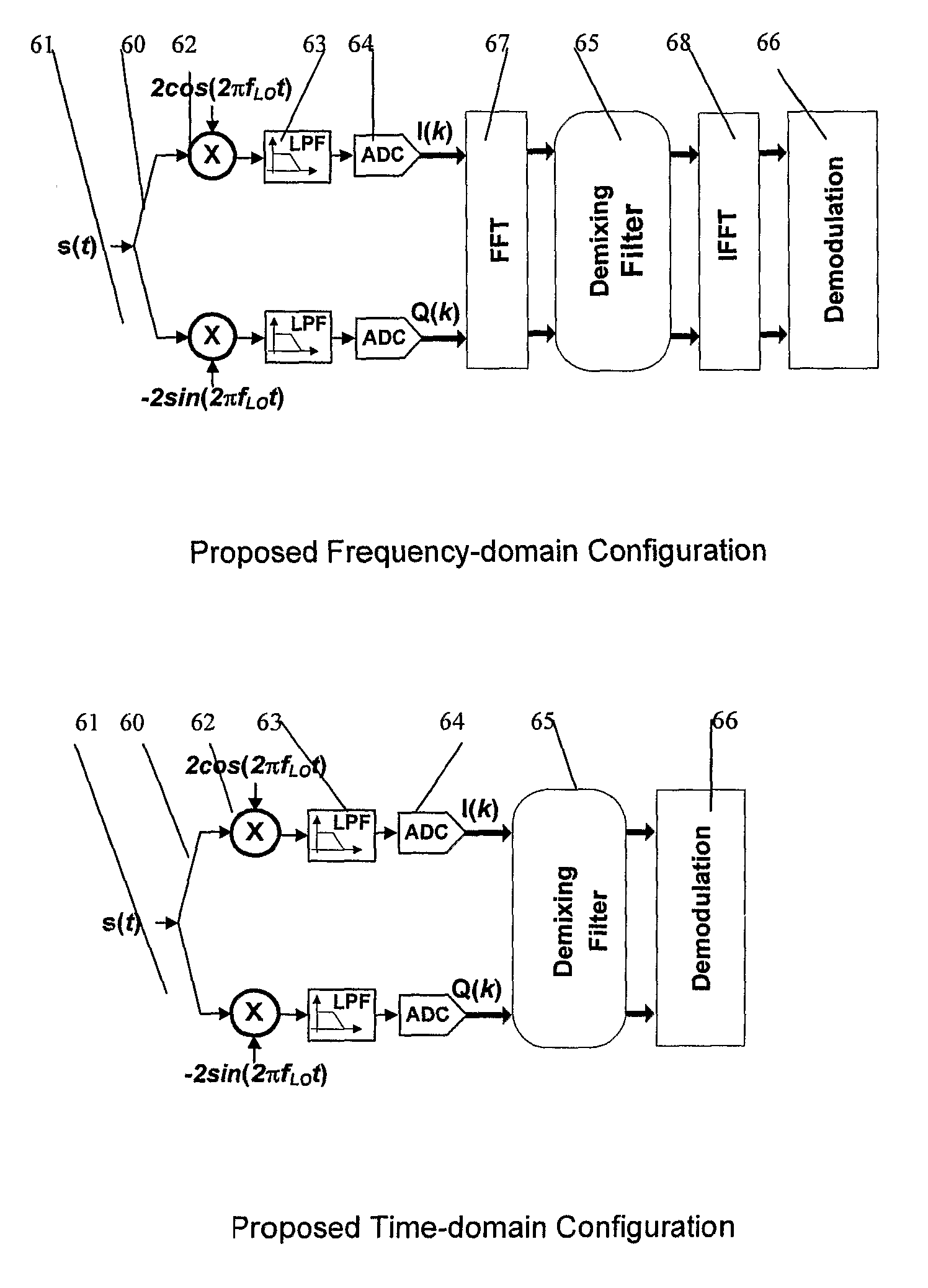
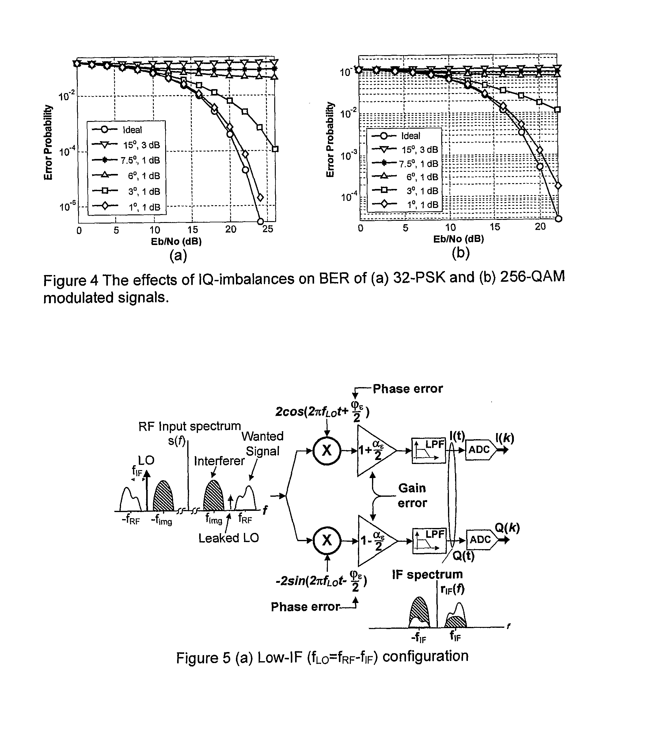
In a satellite radio navigation receiver receiving a transmitted radio navigation signal, a method of removing I / Q-mismatches in the received signal, comprising: resolving the received signal into I and Q signal component, and providing them as inputs to a demixing stage which removes unwanted signals, the demixing stage including first and second cross-coupled adaptive filters, whose coefficients are updated by the outputs of the demixing stage, the outputs of the demixing stage representing an IQ mismatch corrected signal. The coefficients are updated only by the polarity values of the outputs, resulting in great simplification. The receiver may be a zero-IF or low-IF receiver, and may operate on time domain or frequency domain signals.
Need to check novelty before this filing date? Find Prior Art

Description

FIELD OF INVENTION

[0001] The present invention relates to receivers for satellite radio navigation systems, commonly known as GNSS (Global Navigation Satellite Systems), including GPS, GLONASS and Galileo.BACKGROUND OF THE INVENTION

[0002] The Global Positioning System (GPS) comprises 24 satellites in low earth orbit that continually broadcast their position and local time. Through satellite range measurements, a terrestrial (or airborne) receiver can determine its absolute position as long as four satellites are within view.

[0003] Galileo is Europe's initiative for a state-of-the-art Global Navigation Satellite System (GNSS), providing a highly accurate, guaranteed global positioning service. According to the European white paper “European transport policy for 2010: time to decide”, GNSS is identified as a critical technology. Galileo shall be designed and developed using time, geodesy and signal structure standards interoperable and compatible with civil GPS and its augmentations. In ...

Examples

Embodiment Construction

[0036]In the Galileo system, the modulation formats proposed are AltBOC and CASM / modified Hexaphase modulation scheme for E5, E6 and L1 signals respectively. Using the CASM / modified Hexaphase modulation, the L1 signal can be written as:

sL1(t)=[CL1a(t)·DL1a(t)·UL1a·cos(m)-CL1c(t)·UL1b,c·sin(m)]·cos(2πfL1t)-[CL1b(t)·DL1b(t)·UL1b,c·cos(m)+CL1a(t)·DL1a(t)·UL1a(t)·CL1b(t)·DL1b(t)·CL1c(t)·sin(m)]sin(2πfL1t)(2)

[0037]where:[0038]CXY(t) is the ranging code on the Y channel (“Y” stands for I or Q for two channels signals, or A, B or C for three channels signals) of the X carrier frequency (“X” stands for E5a, E5b, E6 or L1).[0039]DXY(t) is the data signal on the Y channel in the X frequency band.[0040]fX, is the carrier frequency in the X frequency band.[0041]UXY(t) is the rectangular subcarrier on the Y channel in the X frequency band.[0042]m is a modulation index, associated to the CASM / modified Hexaphase modulation.

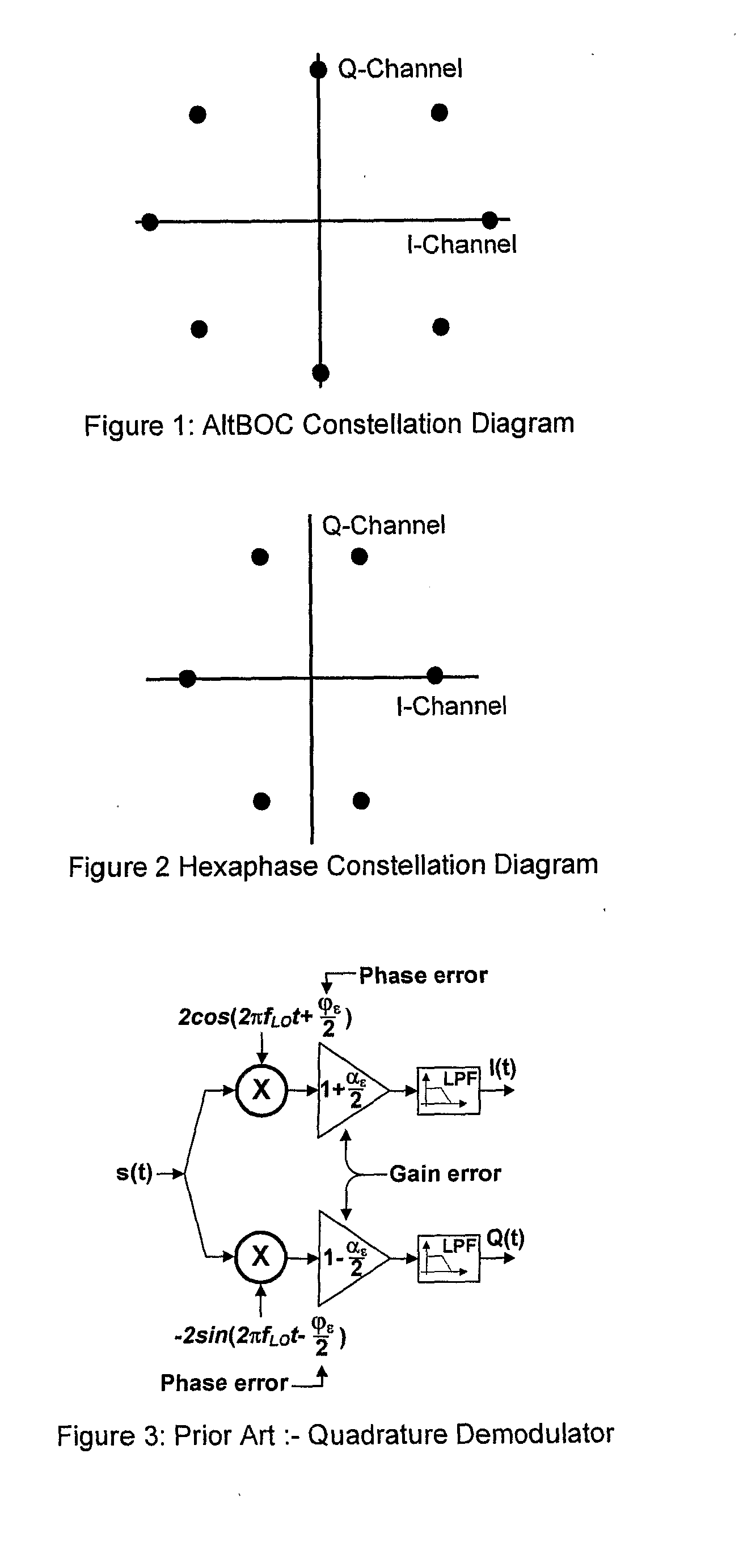
[0043]FIG. 2 shows the constellation diagram, the number of phases is equal...