Field remote sensing system for real-time quantification of total suspended solids (TSS) in surface waters from above-water spectral measurements

a remote sensing system and total suspended solid technology, applied in optical radiation measurement, multi-stage water/sewage treatment, instruments, etc., can solve the problems of inability to provide real-time, high cost of existing field instruments for the estimation of total suspended solids, and difficult use, etc., to achieve high signal-to-noise ratio, simple use, and high signal-to-noise ratio

Active Publication Date: 2019-10-03
ARMSTRONG ROY
View PDF5 Cites 3 Cited by
  • Summary
  • Abstract
  • Description
  • Claims
  • Application Information

AI Technical Summary

Benefits of technology

[0006]What makes the present field remote sensing system unique is its operation from above the water surface to provide real-time TSS data without any processing or technical expertise by the user. There are no existing field radiometers or spectroradiometers capable of providing instant, quantitative TSS data. This portable, easy to use, and inexpensive field remote sensing system combines a miniature high signal-to-noise ratio spectrometer coupled to a credit card-size computer (such as a Raspberry-Pi), lens, rechargeable battery, GPS, motion sensor, display panel, and dedicated software to derive TSS from above-water hyperspectral measurements. The system is simple to use (point and shoot) with data logging and instant readout of the TSS value along with location coordinates and time / date information. It uses one or more empirically-derived algorithms to derive TSS from above-water spectral measurements. The measurement protocol requires measuring the upwelling light signal at 45 degrees from above the water surface, followed by a measurement from a standard grey (18% reflectance) card. It uses these measurements to calculate the remote sensing reflectance, which is used by the spectroscopy-based algorithms to calculate TSS. The TSS and ancillary data are displayed real-time and also logged for later downloading.
[0007]The disclosed field remote sensing system provides TSS quantitative values in real-time, from above-water hyperspectral measurements. Robust algorithms for estimating TSS will utilize derivative analysis to separate their signal from the confounding effects of water surface reflections, variable illumination and other water constituents such as chlorophyll and colored dissolved organic matter. An embodiment of the present disclosure will be designed to be used for monitoring remote and inaccessible areas from small drones, providing data over many stations at high spatial resolution (cm scale) and high temporal frequency (daily, hourly or more frequent). This is impossible or impractical to do with the existing submerged sensor technology for water quality parameters. While ocean color satellite sensors can provide turbidity estimates from space, the spatial resolution of these sensors is too coarse (1-4 kilometer pixel sizes) to be useful for measuring and monitoring water quality parameters in small lakes, rivers, lagoons, estuaries, reservoirs, and coastal areas. In addition, frequent cloud cover also significantly reduces the number of useful satellite images.

Problems solved by technology

As previously noted, traditional monitoring methods for water quality depend on field sampling and time-consuming laboratory analyses that cannot provide real-time results.
Existing field instruments for the estimation of TSS are expensive, hard to use, require technical expertise, frequent calibration in the laboratory using standards, and can only operate submerged.
There are no existing field radiometers or spectroradiometers capable of providing instant, quantitative TSS data.
This is impossible or impractical to do with the existing submerged sensor technology for water quality parameters.
While ocean color satellite sensors can provide turbidity estimates from space, the spatial resolution of these sensors is too coarse (1-4 kilometer pixel sizes) to be useful for measuring and monitoring water quality parameters in small lakes, rivers, lagoons, estuaries, reservoirs, and coastal areas.
In addition, frequent cloud cover also significantly reduces the number of useful satellite images.

Method used


Image

  • Field remote sensing system for real-time quantification of total suspended solids (TSS) in surface waters from above-water spectral measurements
  • Field remote sensing system for real-time quantification of total suspended solids (TSS) in surface waters from above-water spectral measurements
  • Field remote sensing system for real-time quantification of total suspended solids (TSS) in surface waters from above-water spectral measurements

Examples


Embodiment Construction

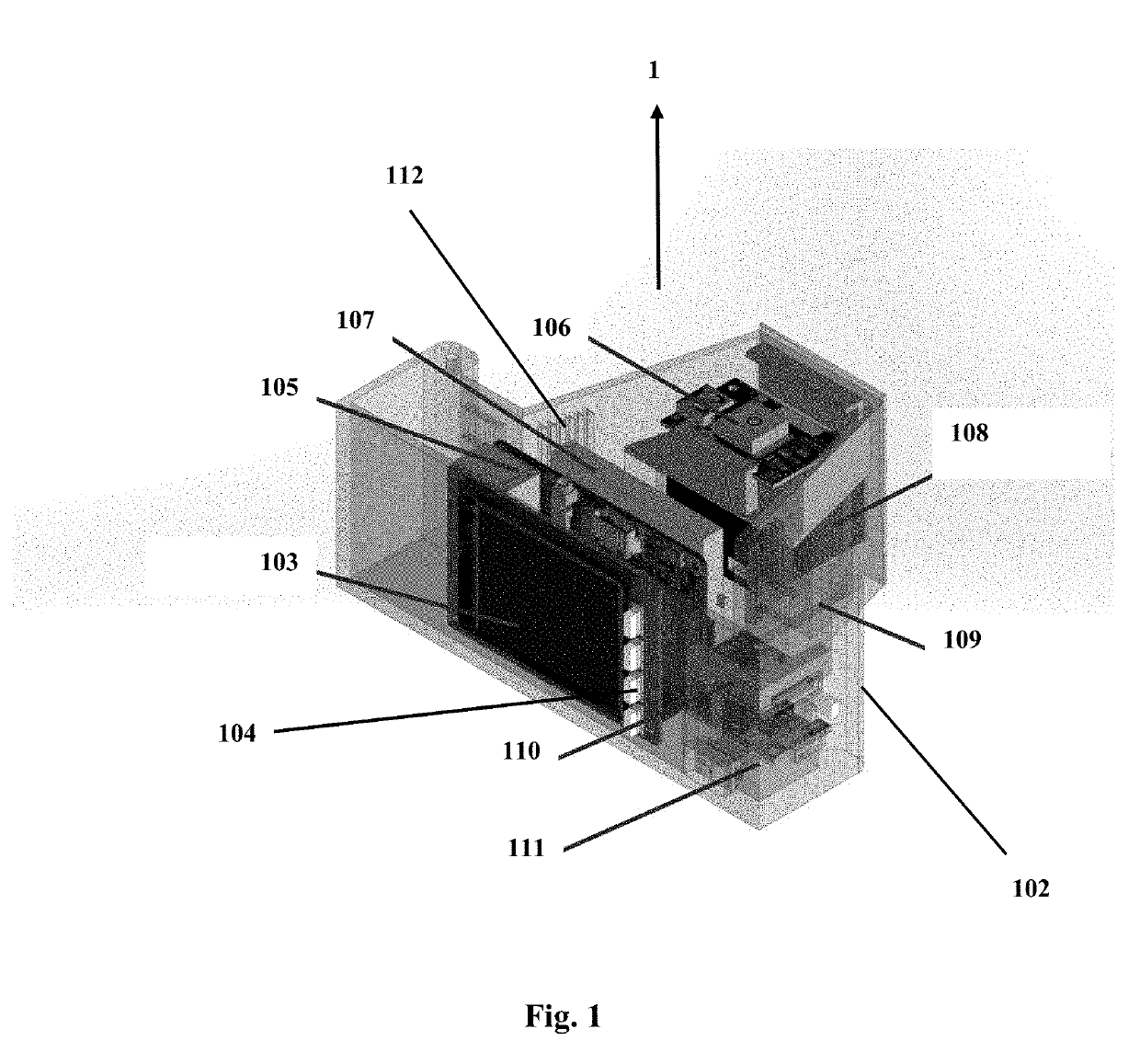
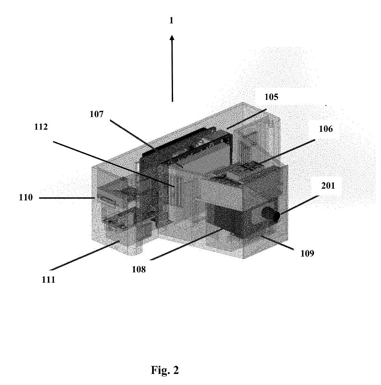
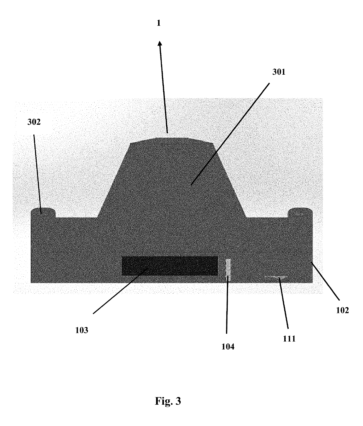
[0013]In the following description, a portable remote sensing system (“RSS”) unit for real-time assessments of total suspended solids (“TSS”) in surface waters using above-water hyperspectral measurements is provided. The RSS unit provides TSS values in real-time, without the cumbersome and time consuming traditional laboratory methodology or the expensive and difficult to use existing in situ sensor technology. It should be noted that the RSS unit is not limited to assessing TSS in surface waters; it can also be used to detect and quantify other parameters of water quality such as chlorophyll, colored dissolved organic matter (“CDOM”), blue-green algae, etc.

[0014]The system combines a miniature high signal-to-noise ratio spectrometer coupled to a credit card-size computer, lens, rechargeable battery, GPS, display panel, motion sensor and dedicated software to derive TSS from above-water spectral measurements. The operating and analysis software incorporates one or more empirically ...


PUM

PropertyMeasurementUnit
right anglesaaaaaaaaaa
reflectanceaaaaaaaaaa
angleaaaaaaaaaa

Abstract

A portable remote sensing system for real-time assessments of total suspended solids (TSS) in surface waters using above-water hyperspectral measurements. The system combines a miniature high signal-to-noise ratio spectrometer coupled to a credit card-size computer, lens, rechargeable battery, GPS, display panel, and dedicated software to derive TSS from above-water spectral measurements.

Description

BACKGROUND OF THE INVENTION[0001]Water quality impacts both human health and socioeconomic development. Inland water quality monitoring of sediment loads is required for providing safe water for human consumption and as an indicator of the health of aquatic ecosystems. There is a current need for a rapid and cost-effective method and / or system for assessing water quality indicators such as total suspended solids (TSS) in lakes, streams, reservoirs and coastal waters. Traditional monitoring methods for water quality depend on field sampling and time-consuming laboratory analyses that cannot provide real-time results. Existing field sensors for the estimation of turbidity are expensive, hard to use, require technical expertise, frequent calibration in the laboratory using standards, and can only operate submerged. For example, existing field instruments for estimating TSS, such as the ones described in U.S. Pat. Nos. 4,890,484, 5,032,794, 5,790,471, 9,448,152 and 9,493,370 are hard to...

Claims


Application Information

Patent Timeline
Patent Type & Authority Applications(United States)
IPC IPC(8): C02F9/00G06F3/041G01S19/01H04W72/12
CPCC02F2209/10C02F2209/11H04W72/1284C02F9/005G01S19/01G06F3/041G01J3/4406G01J1/46G01J2001/446G01J2001/4433G01J3/0286G01J3/0291G01J3/027G01N2015/0053G01N2015/0693G01J3/433C02F2209/105C02F2209/21G01J3/42C02F9/20H04W72/21
Inventor ARMSTRONG, ROY
Owner ARMSTRONG ROY
Why Eureka
Try Eureka