System and method for using corrected signals from a global positioning system to perform precision survey

a global positioning system and surveying technology, applied in navigation instruments, wireless commuication services, instruments, etc., can solve problems such as narrow band radios, reduced performance and system failure, and adverse effects on satellite transmissions, so as to reduce the overall system power requirement, improve reliability, and reduce the effect of spectrum capacity

Inactive Publication Date: 2006-09-19
TRIMBLE NAVIGATION LTD
View PDF23 Cites 53 Cited by
  • Summary
  • Abstract
  • Description
  • Claims
  • Application Information

AI Technical Summary

Benefits of technology

[0016]In terms of broad inclusion, it is the intention of this invention to provide a user such as a surveyor with a system that is highly integrated, comfortable to use in the field, power efficient, and automated.
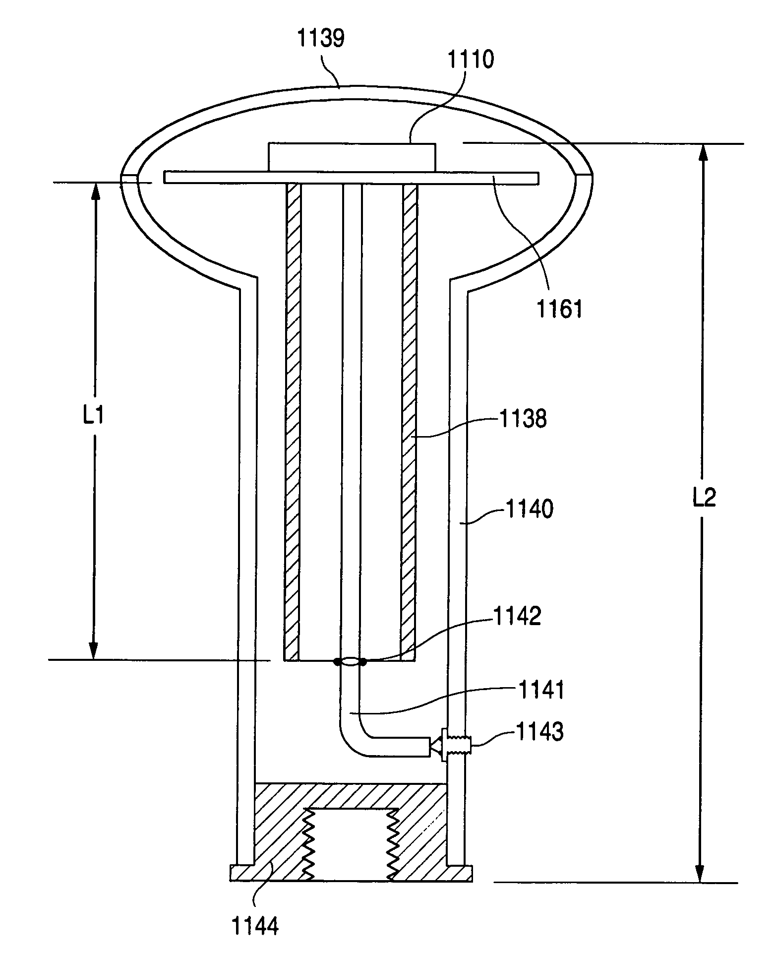
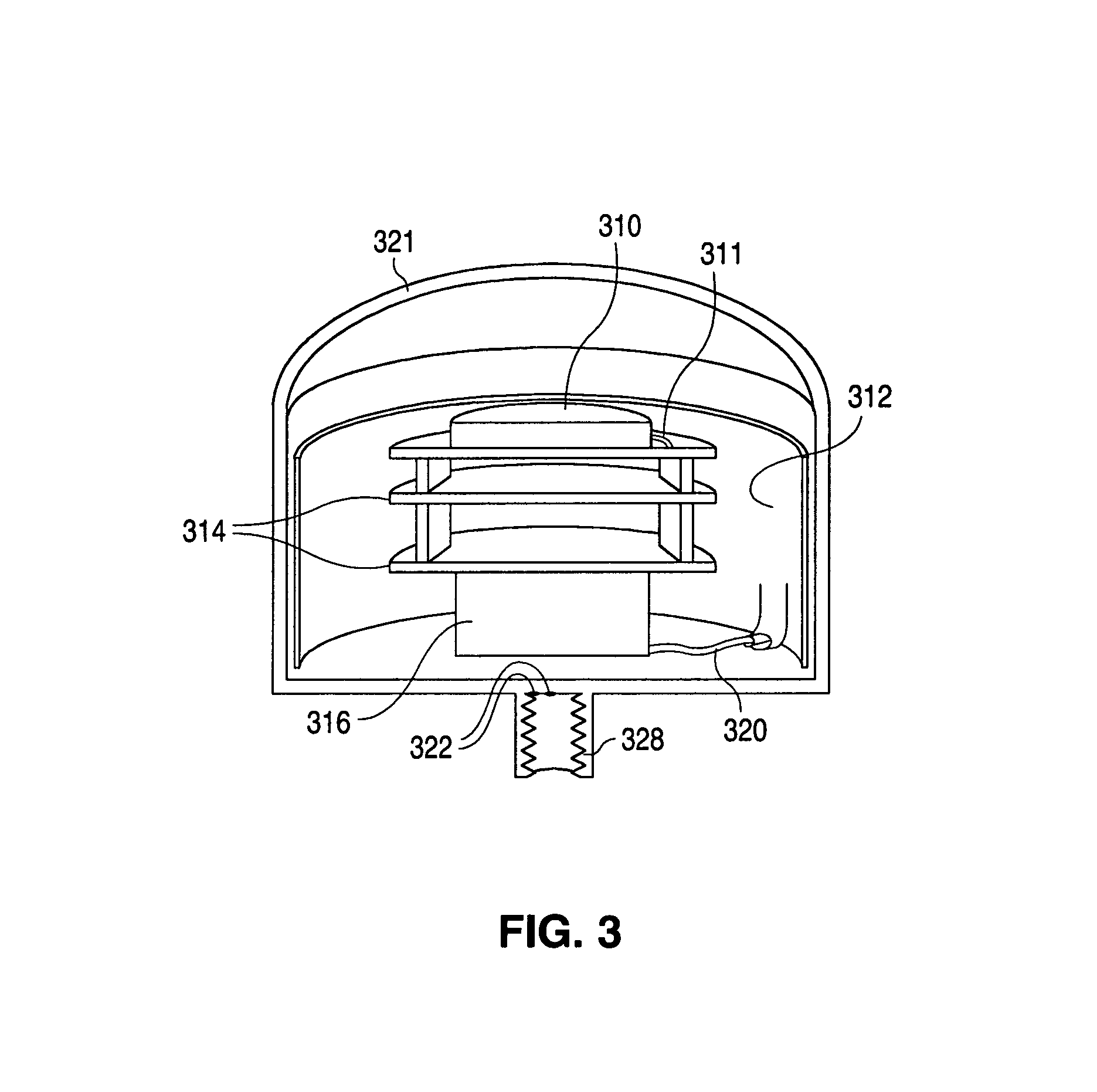
[0017]A high degree of integration, and opportunity to increase manufacturability with lower cost, is achieved by this invention with the base station GPS receiver packaged in the same environmentally sealed enclosure as the base station transceiver. This invention will also describe an integrated base station antenna system that combines the GPS antenna with the radio modem antenna. The base station system described in this invention is power efficient because it has the ability to only transmit corrections when requested by the rover unit, and then to only transmit corrections that will be the most contemporary (e.g. useful). The base station system described in this invention relieves the surveyor of making a manual and subjective selection of the best channel for the wireless link by providing the provisions for automatic channel selection capability.

Problems solved by technology

In addition to the deliberately induced SA error, satellite transmissions are also adversely affected (essentially delayed in time) by the atmosphere, ionosphere and by reflected signals that are time delayed as a result of not traveling to the GPS receiver on a straight path.
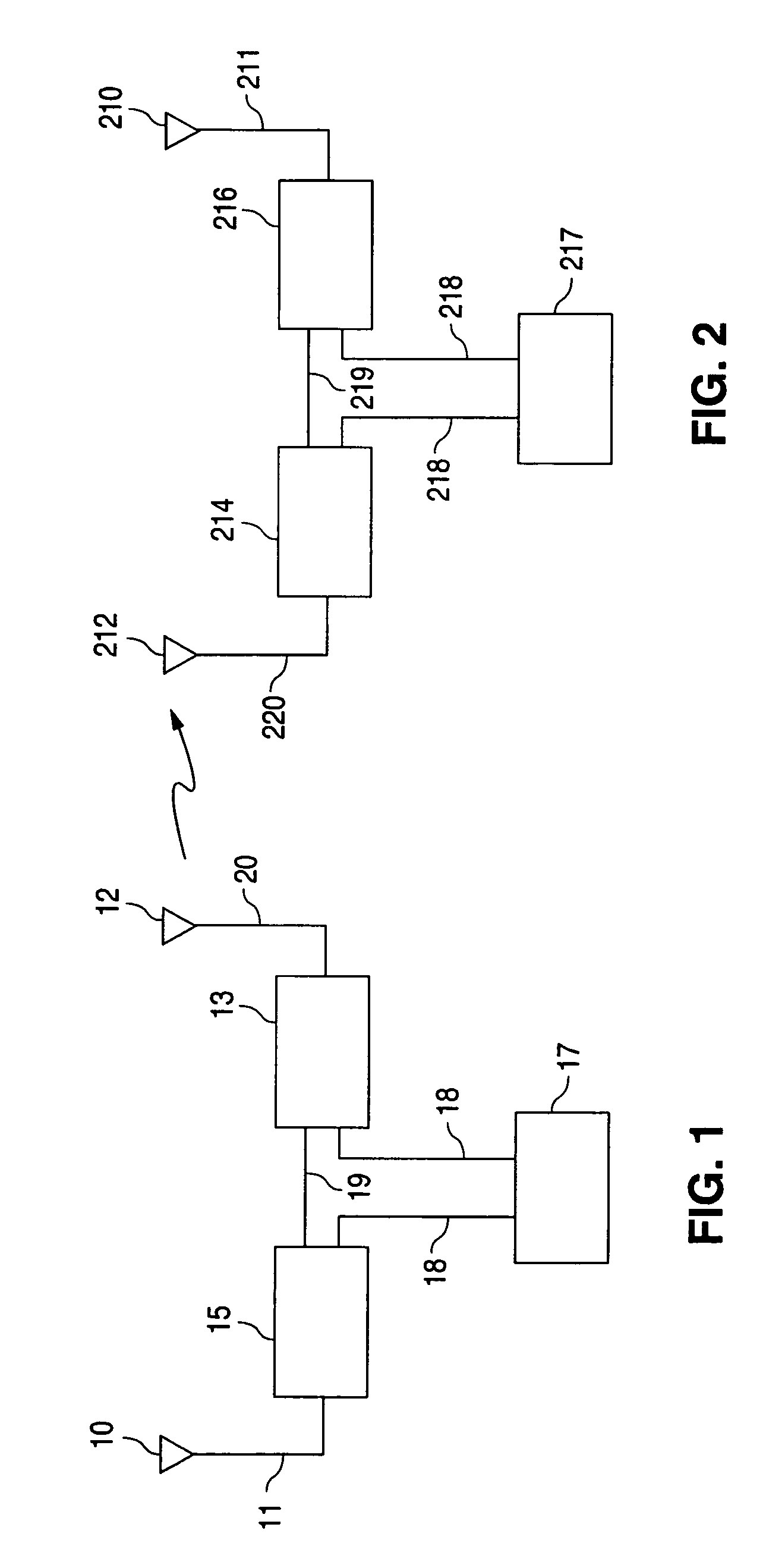
It is always desirable to reduce the number of cables (e.g. 211, 220, 218, 219) in the system since these are inconvenient to attach and detach and are invariably sources of reduced performance and system failure.
Narrow band radios have the disadvantage of requiring that a license be obtained from the Federal Communications Commission (FCC), or local regulatory body, prior to operation.
Thus far this integration has been limited to the rover systems only and has involved radio modems that are capable only of receiving (e.g. they have no transmitters) data transmissions.
Surveyors have complained that this particular system is top-heavy and unwieldy, being placed at the top of a hand-held pole.

Method used


Image

  • System and method for using corrected signals from a global positioning system to perform precision survey
  • System and method for using corrected signals from a global positioning system to perform precision survey
  • System and method for using corrected signals from a global positioning system to perform precision survey

Examples


Embodiment Construction

[0042]One embodiment of a base station of the invention is illustrated in FIG. 6. The invention involves putting the base station GPS receiver into the same enclosure as the radio modem that transmits the satellite corrections, as illustrated in FIG. 6. The body of the housing or enclosure 626 is made of extruded aluminum for its lightweight properties, heat conduction capabilities, and electrically shielding ability. The front panel assembly 627 is comprised of an aluminum front panel with provisions for user interface through the use of two push buttons, various Light Emitting Diode (LED) status indicators, and a seven segment numeric display. The front panel assembly attaches to the body of the enclosure with screws 628 and the union is sealed with an elastomeric gasket 629. This gasket 629 also serves to provide a measure of vibration isolation when the station is resting on a flat surface because the elastomeric gasket 629 will provide the supporting contact area for the base s...


PUM


Abstract

In a differential global positioning system that includes one or more base stations and rover units, a system and method for including a radio modem transceiver in the rover units, and packaging several components, including the transceiver and a radio antenna in a single package, and possibly including re-chargeable batteries, a GPS receiver, and a GPS antenna in the package, to reduce the number of external electrical connections. Several of the components may be packaged into a survey range pole. GPS satellite correction information is transmitted from a base station in response to a request transmitted from the rover unit by means of the radio modem transceiver. Automatic channel selection is performed by the base stations to select a channel having low communication traffic. The rover units scan the available channels for valid GPS correction information and, in the event that more than one such channel is located, select the channel with the strongest signal.

Description

[0001]This is a continuation application of previously filed application Ser. No. 09 / 663,063 that was filed on Sep. 15, 2000, now U.S. Pat. No. 6,751,467 under the same title as the present application.BACKGROUND OF THE INVENTION[0002]1. Field of the Invention[0003]This invention relates to an improved system and method of using corrected signals from a Global Positioning System to perform precision surveying.[0004]2. Discussion of the Prior Art[0005]U.S. Pat. Nos. 5,519,620 and 5,602,741 describe some prior art Global Positioning systems. The Global Positioning System (GPS) is a satellite-based system that provides users with real-time position information originally intended for navigational purposes. This system is comprised of a constellation of 24 satellites with sufficient redundancy such that about 6 satellites are typically visible to users at any time or location on the planet. Transmissions from at least 4 satellites must be received in order for users to fix the latitude,...

Claims


Application Information

Patent Timeline
Patent Type & Authority Patents(United States)
IPC IPC(8): H04B7/00G01S19/44G01S19/04G01S19/10G01S19/46
CPCG01C15/00G01S19/35G01C15/06
Inventor CAMERON, JOHN F.SELLERS, MARK D.
Owner TRIMBLE NAVIGATION LTD
Why Eureka
Try Eureka