Corn biomass inversion calculation method based on satellite radar remote sensing data

A technology of remote sensing data and biomass, which is applied in the field of satellite remote sensing image processing and application, and can solve problems such as high algorithm complexity, strong human subjective factors, and multiple measured point information

Active Publication Date: 2019-09-27
JILIN UNIV
View PDF9 Cites 11 Cited by
  • Summary
  • Abstract
  • Description
  • Claims
  • Application Information

AI Technical Summary

Problems solved by technology

[0005]In order to solve the problem of strong artificial subjective factors, high algorithm complexity and more requirements in the existing synthetic aperture radar remote sensing images in the inversion of corn biomass The shortcomings of actual measurement point information, etc., the present invention adopts a corn biomass inversion method based on the combination of machine learning and water cloud model in Northeast China, which can quickly and effectively obtain the corn biomass information in high-resolution remote sensing radar images

Method used


Image

  • Corn biomass inversion calculation method based on satellite radar remote sensing data
  • Corn biomass inversion calculation method based on satellite radar remote sensing data
  • Corn biomass inversion calculation method based on satellite radar remote sensing data

Examples


Embodiment 1

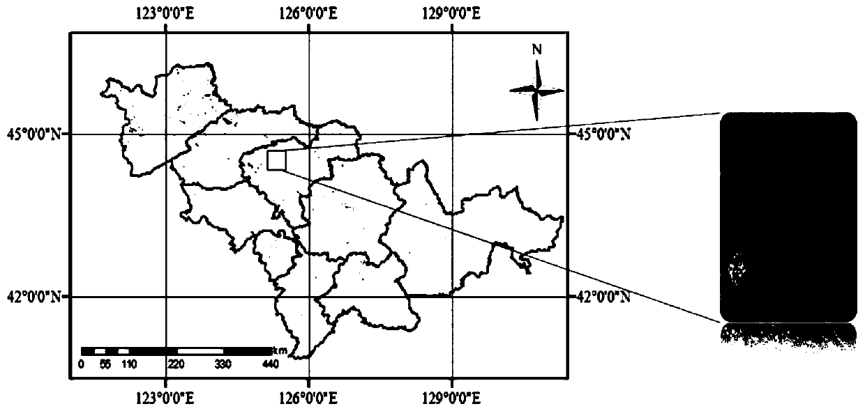
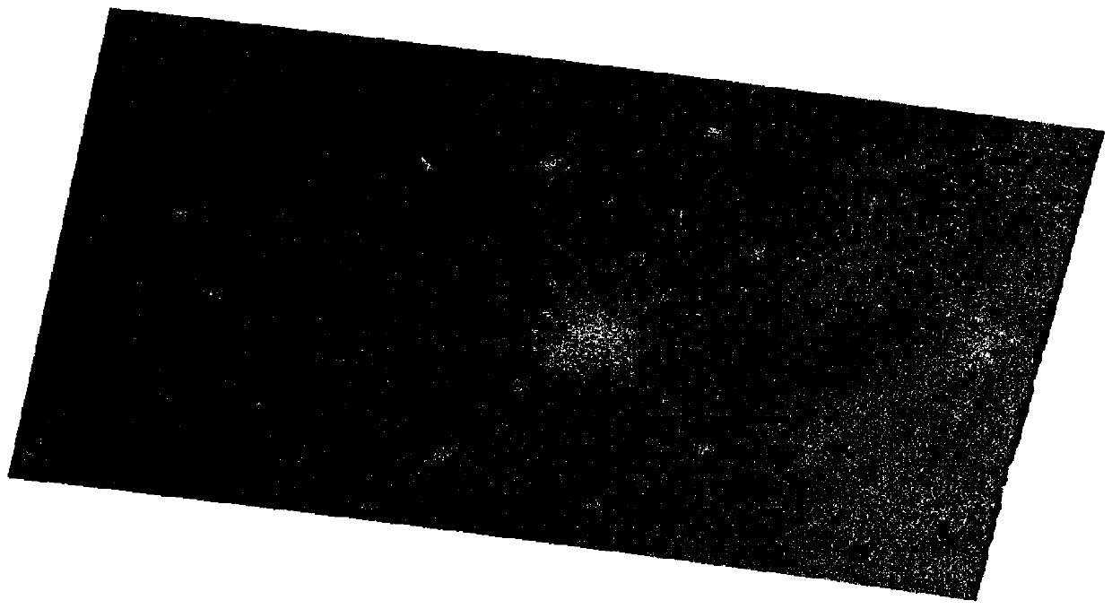
[0040] The data source is the multi-temporal Sentinel-1 radar image, which is an earth observation satellite in the Copernicus program (GMES) of the European Space Agency. It consists of two radar satellites, Sentinel-1A and Sentinel-1B, carrying C-band synthetic aperture radar that provides continuous imagery (day, night and all weather). Sentinel-1 has a spatial resolution of 20m. The experimental data includes 4 scene data, and the acquisition time is 2017 / 6 / 28, 2017 / 7 / 22, 2017 / 8 / 15, 2017 / 9 / 8. The experimental area is located near Nong'an County, Changchun City, Jilin Province ( figure 1 ), the surrounding vegetation is densely planted, and corn is the main crop. Field experiments were carried out in the experimental area in 2017, and the surrounding corn growth was uniform and full, and 33 representative locations were selected to measure the latitude and longitude information and corn biomass as the measured data for processing and analysis.

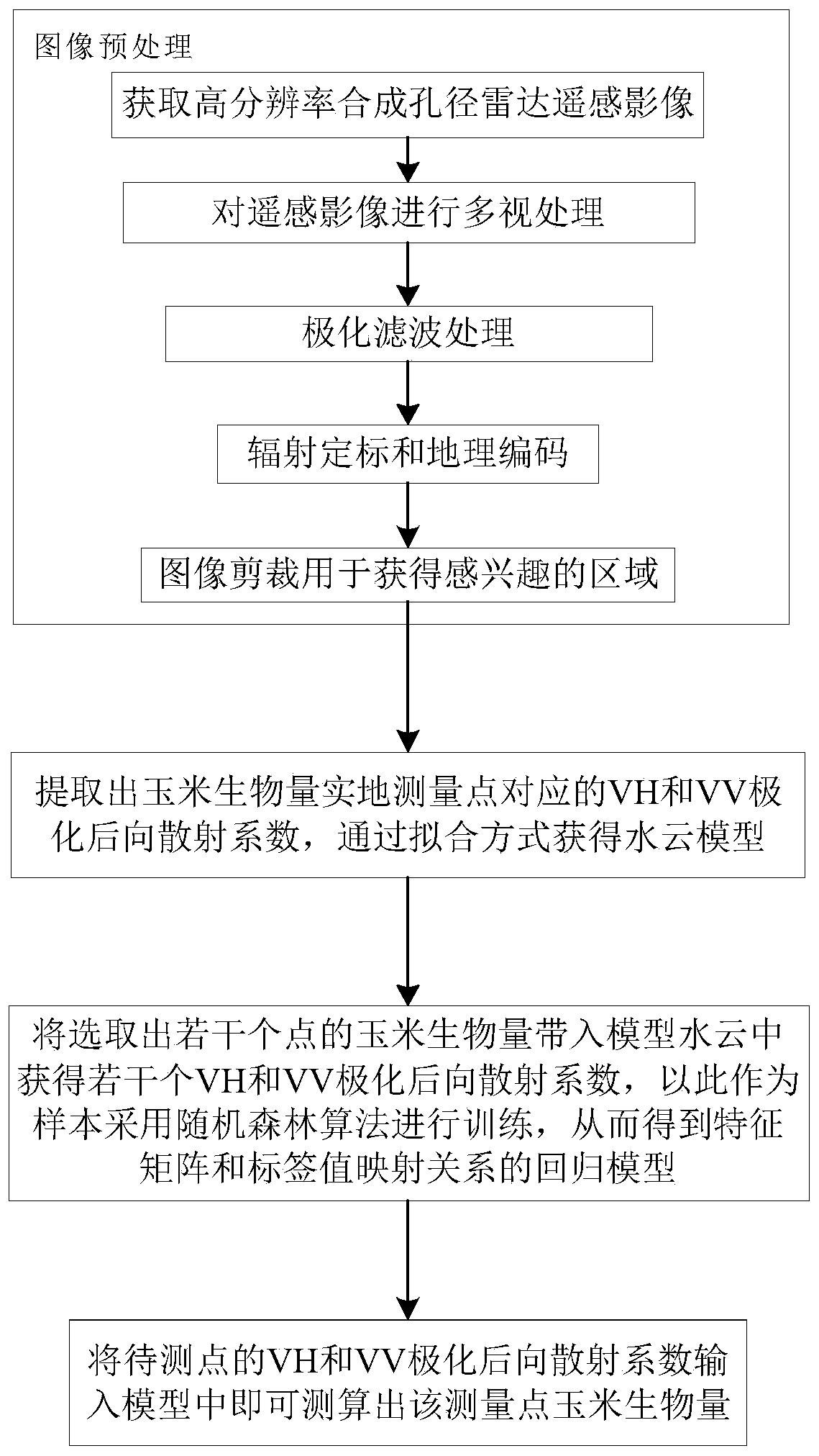
[0041] Step 1: Image prep...


PUM


Abstract

The invention discloses an inversion calculation method based on satellite radar remote sensing data. The invention belongs to the technical field of satellite remote sensing image processing and application. The objective of the invention is to overcome the defects of high artificial subjective factor, high algorithm complexity, high requirement on actual measurement point information and the like in corn biomass inversion by using a synthetic aperture radar remote sensing image in the prior art. The method comprises the following steps: preprocessing an image; firstly, extracting VH and VV polarization backscattering coefficients corresponding to corn biomass on-site measurement points; acquiring a water cloud model through a fitting mode; substituting the corn biomass with a plurality of selected points into the model water cloud to obtain a plurality of VH and VV polarization backscattering coefficients; and training by adopting a random forest algorithm to obtain a regression model of the mapping relation between the characteristic matrix and the label value, and inputting the VH and VV polarization backward scattering coefficients of the to-be-measured point into the model to measure and calculate the corn biomass of the measurement point.

Description

technical field [0001] The invention belongs to the technical field of satellite remote sensing image processing and application. Background technique [0002] Crop biomass inversion is of great significance in many fields such as agricultural resource survey, land use status analysis, crop yield estimation and disaster assessment, and has become one of the research hotspots in the field of remote sensing in recent years. Among many methods of inversion of crop biomass using remote sensing images, the algorithm based on the radiative transfer model is affected by the images of different microwave scattering mechanisms of ground objects, so it is difficult to be widely used in a wide range. With the rapid development of microwave remote sensing technology in recent years, the amount of available satellite data has gradually increased significantly. For multi-temporal big data radar images, the regression modeling method based on machine learning has also achieved a lot of res...

Claims


Application Information

Patent Timeline
Patent Type & Authority Applications(China)
IPC IPC(8): G06F17/18G06F16/29G01S13/90G01S7/41
CPCG06F17/18G06F16/29G01S13/90G01S7/41G01S13/9027
Inventor 顾玲嘉贺法川任瑞治
Owner JILIN UNIV
Why Eureka
Try Eureka