Method and system for ground point fitting and crop height extraction based on point cloud data
A point cloud data and ground point technology, applied in image data processing, image analysis, image enhancement, etc., can solve the problems that soil cannot be collected by UAV images, crop height extraction error, point cloud cannot meet the requirements, etc., to achieve Low cost, high applicability, and the effect of overcoming errors
- Summary
- Abstract
- Description
- Claims
- Application Information
AI Technical Summary
Problems solved by technology
Method used
Image

Examples
Embodiment 1
[0056] The method for fitting ground points based on point cloud data provided in this embodiment includes the following steps:
[0057] First, obtain 3D point cloud data with plant areas;
[0058] Then, the plant canopy data information is determined according to the point cloud data; the plant canopy data information is determined according to the following steps:
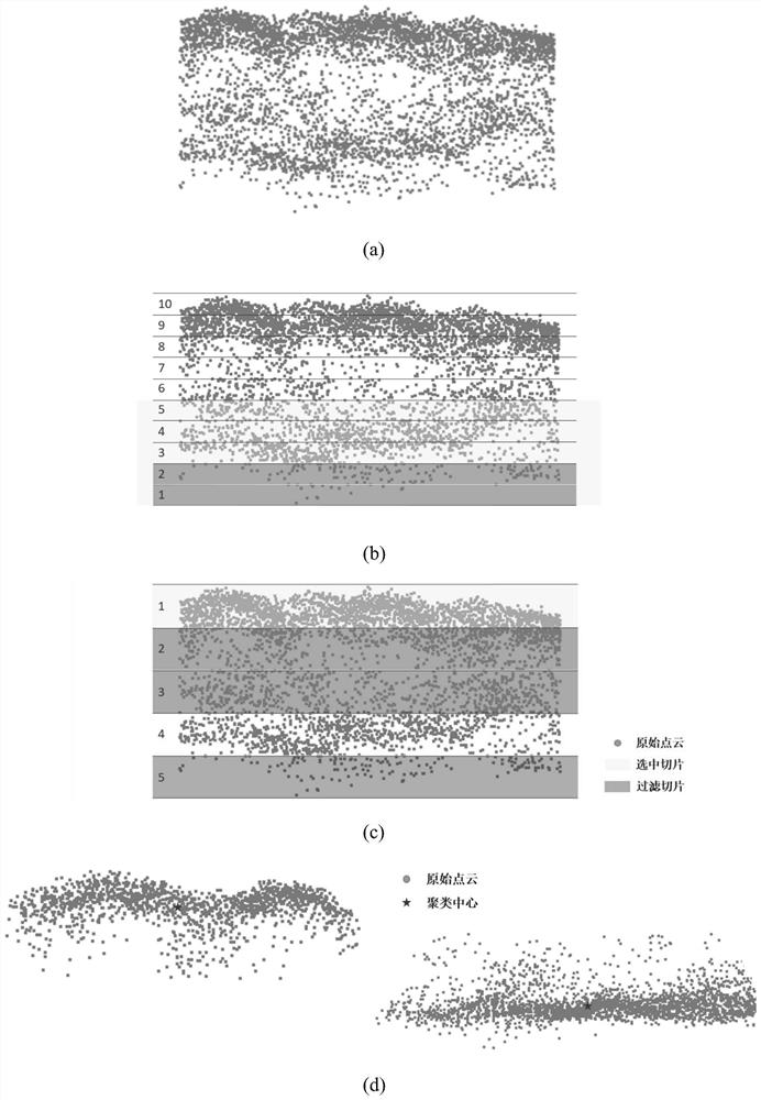
[0059] The point cloud data is partitioned according to the plant spacing, a bounding box is established, and a slice is constructed according to the bounding box; the construction of the bounding box and the slice is carried out according to the following steps:
[0060] A bounding box is established according to the point cloud distribution of the sub-region, and the point cloud is divided into multiple points with a thickness of H from bottom to top in the z-axis direction. 1 , and then divide the point cloud into multiple slices with a thickness of H from top to bottom. 2 of slices, twice slice thickness H ...
Embodiment 2
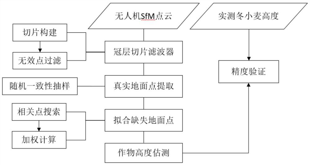
[0075] The method for extracting the height of crops based on the fitting of UAV point cloud and ground points provided in this embodiment realizes the real restoration of terrain fluctuations by extracting real ground points and fitting missing ground points, eliminating terrain fluctuations and extracting height of winter wheat. interference. In addition, the canopy slice filter is applied to optimize the extraction process of ground points to obtain effective information in the original point cloud, including the following steps:
[0076] Step 1. Obtain the drone image of the crop planting area and generate the 3D point cloud through the SfM algorithm;
[0077] Step 2. Preprocess the original point cloud, including data cropping and format conversion;
[0078] Step 3. Divide the point cloud according to the actual crop planting spacing, and construct bounding boxes and internal slices;
[0079] Step 4. Cluster the point clouds in the bounding box, and preliminarily determ...
Embodiment 3
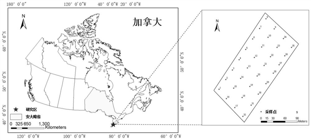
[0101] like figure 1 and figure 2 shown, figure 1 It is a schematic flow chart of the overall method of the present invention, figure 2 It is a schematic diagram of the winter wheat farmland research area in the specific embodiment of the present invention. The selected research area is the winter wheat planting area near Melbourne in southeastern Ontario, Canada. figure 2 The actual measurement of the height of winter wheat was carried out on different observation dates.
[0102] The method for extracting the height of crops based on the fitting of UAV point clouds and ground points provided in this embodiment includes the following steps:
[0103] Step 1: Set 32 sampling points evenly in the study area to measure the height change of winter wheat during the growth cycle. During this process, digital images of UAVs in the experimental area are captured synchronously, and the SfM algorithm is used to generate point cloud data containing three-dimensional coordinates b...
PUM
| Property | Measurement | Unit |
|---|---|---|
| Thickness | aaaaa | aaaaa |
Abstract
Description
Claims
Application Information
 - Generate Ideas
- Intellectual Property
- Life Sciences
- Materials
- Tech Scout
- Unparalleled Data Quality
- Higher Quality Content
- 60% Fewer Hallucinations
Browse by: Latest US Patents, China's latest patents, Technical Efficacy Thesaurus, Application Domain, Technology Topic, Popular Technical Reports.
© 2025 PatSnap. All rights reserved.Legal|Privacy policy|Modern Slavery Act Transparency Statement|Sitemap|About US| Contact US: help@patsnap.com