Wet land microwave remote sensing and monitoring method
A remote sensing monitoring and wetland technology, applied in radio wave measurement systems, measurement devices, and radio wave reflection/re-radiation, etc., can solve the problems of low resolution, high cost, poor mobility, etc. The effect of low power consumption
- Summary
- Abstract
- Description
- Claims
- Application Information
AI Technical Summary
Problems solved by technology
Method used
Image
Examples
Embodiment Construction
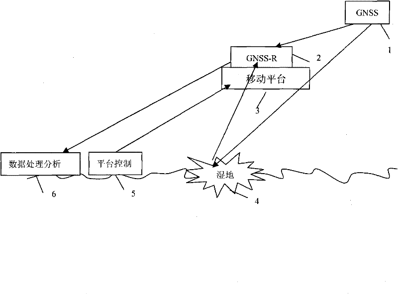
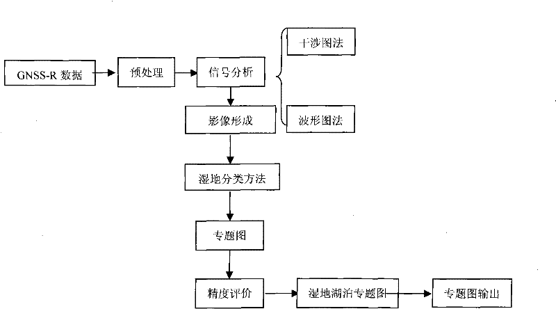
[0039] The present invention will be further described below in conjunction with the drawings. Such as Figure 1-2 As shown, a wetland microwave remote sensing monitoring method uses the L-band microwave signal provided by the GNSS signal source 1 to receive the direct signal S from the GNSS signal source 1 through the GNSS-R receiver 2 d And the forward scattered signal S containing the information of the ground object after being scattered by the surface of the ground object s , And then transmitted to the data processing analysis system 6 for processing and analysis; the wetland microwave remote sensing monitoring system based on GNSS-R technology, including GNSS signal source 1, GNSS-R receiver 2, mobile platform 3, platform control system 5 and data processing analysis System 6, the GNSS signal source 1 is connected to the GNSS-R receiver 2 through the L-band microwave signal, and the GNSS-R receiver 2 is installed on the mobile platform 3 through the inherent land surface ...
PUM
 Abstract
Description
Claims
Application Information
 - R&D
- Intellectual Property
- Life Sciences
- Materials
- Tech Scout
- Unparalleled Data Quality
- Higher Quality Content
- 60% Fewer Hallucinations
Browse by: Latest US Patents, China's latest patents, Technical Efficacy Thesaurus, Application Domain, Technology Topic, Popular Technical Reports.
© 2025 PatSnap. All rights reserved.Legal|Privacy policy|Modern Slavery Act Transparency Statement|Sitemap|About US| Contact US: help@patsnap.com


