

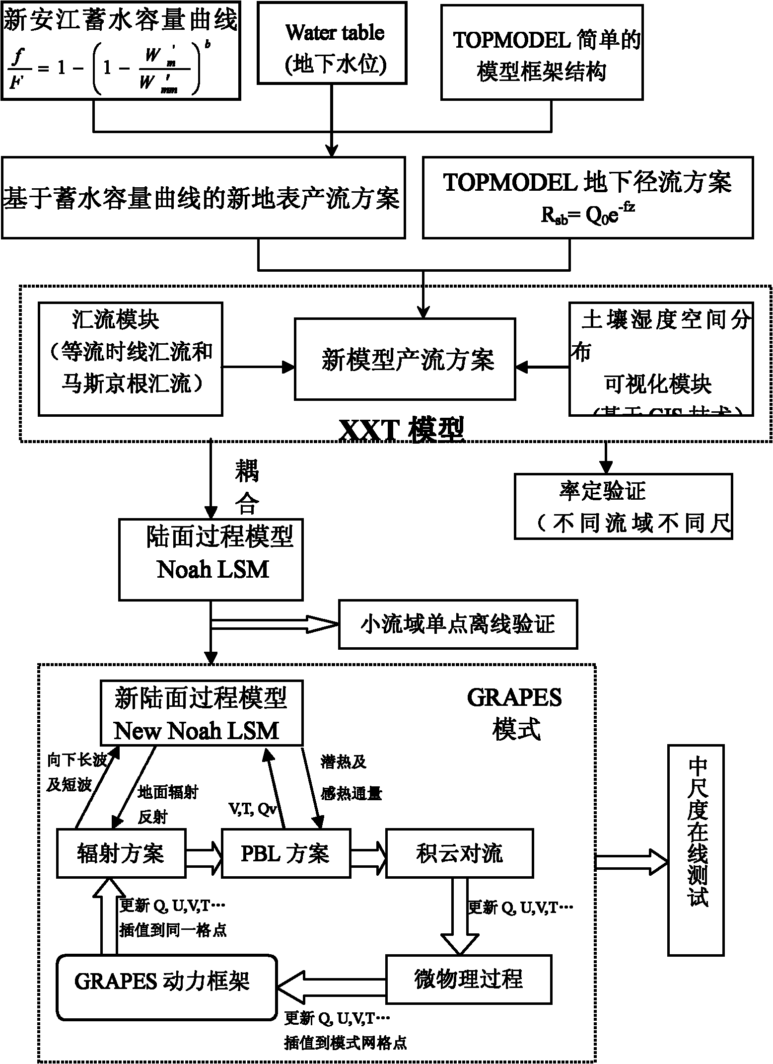
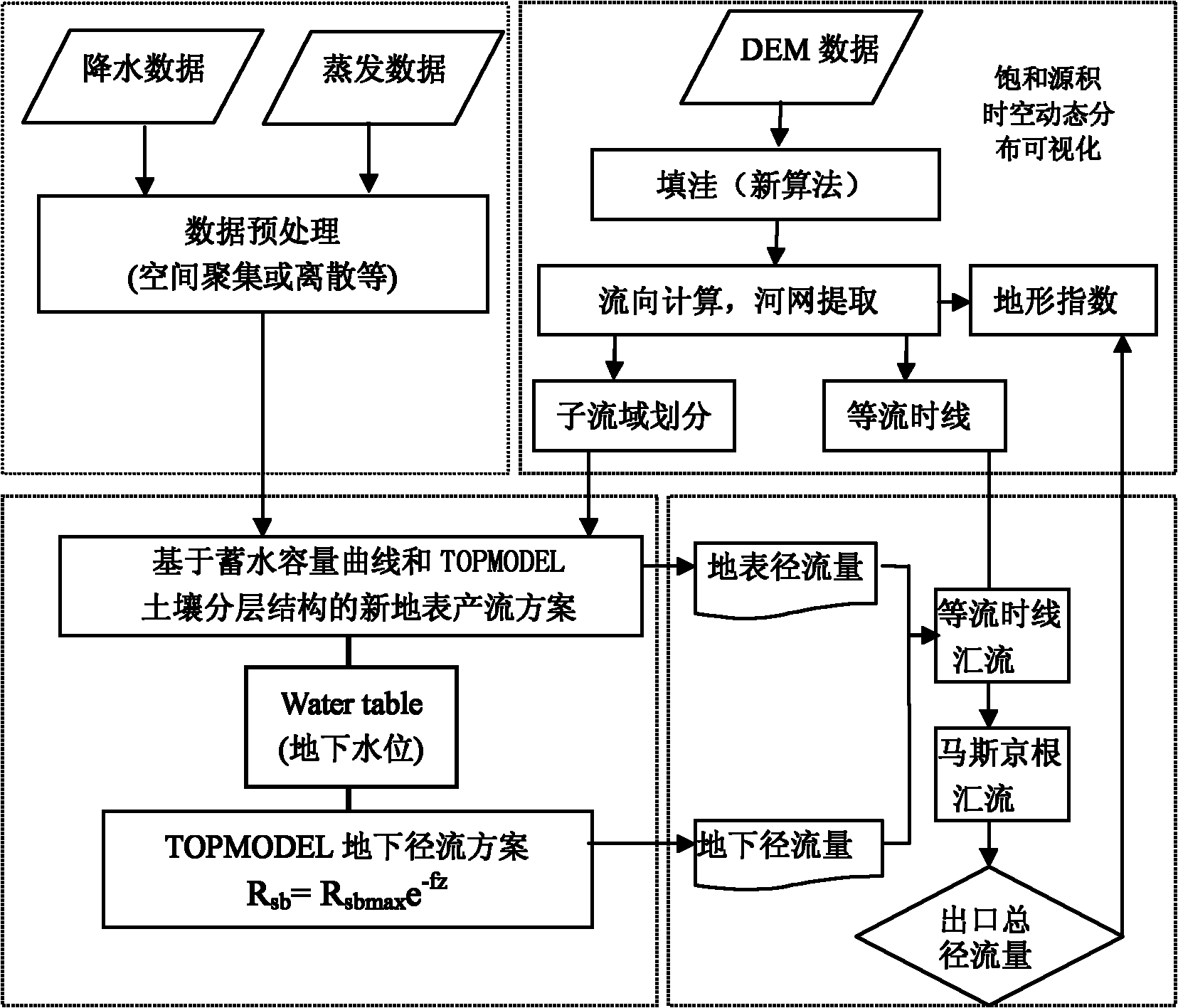
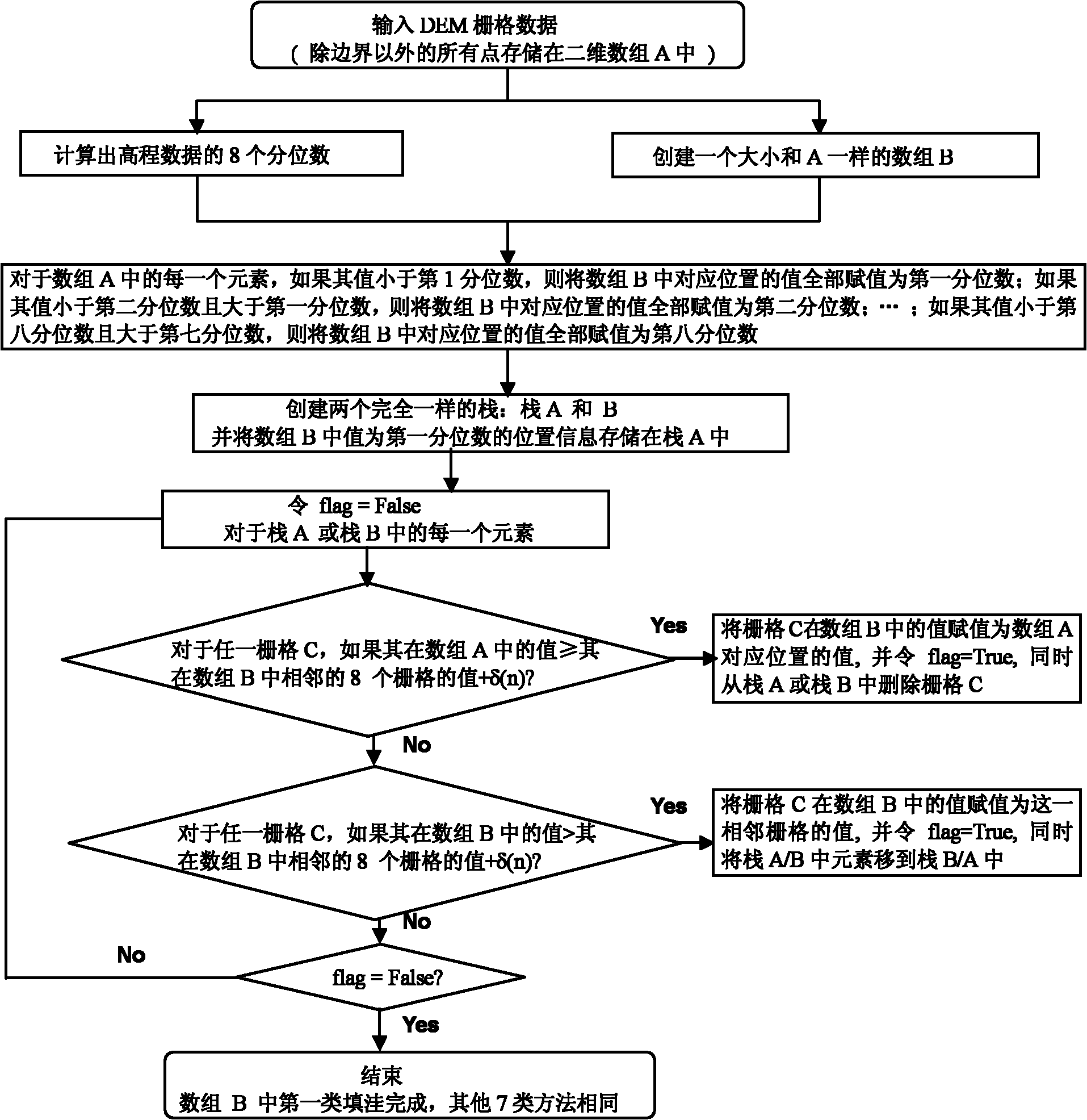
Watershed hydrological model design method based on storage capacity curve and TOPMODEL
A water storage capacity and design method technology, applied in calculation, special data processing applications, instruments, etc., can solve the inability to accurately describe the hydrological process of the land surface and shallow surface, uneven soil moisture space, and parameterized schemes for flow generation and confluence too simple
- Summary
- Abstract
- Description
- Claims
- Application Information
AI Technical Summary
Problems solved by technology
Method used
Image

Examples
Embodiment
[0122] The catchment area of Youshui Street in the small watershed is about 908km 2 , which is located in the central part of southern Shaanxi, at the border of Ankang and Hanzhong in Shaanxi Province. The control station is located at the Youshui Street Hydrological Station (33°17′N, 107°46′E) in the Youshui River Basin, a tributary of the Han River. The landform conditions in the basin are complex, the climate changes are diverse, and the vertical differences are obvious. It is a typical subtropical humid climate zone, with an average temperature change between 7.7-15.7°C and annual precipitation changes between 730-1230mm. The soil type is relatively simple, mainly including yellow-cinnamon soil and yellow-brown soil, etc. The soil texture is mainly mountainous soil with large particles. The altitude range of the study area is 425-2960m, and there are many types of plants. The distribution of plants is dominated by temperate components. It has the natural characteristics...
PUM
 Abstract
Description
Claims
Application Information