Mixed pixel decomposition method for remote sensing images
A technology of mixed pixel decomposition and remote sensing image, which is applied in the field of remote sensing image processing, can solve problems such as the inability to obtain an optimal solution, and achieve the effect of overcoming easy local minima and effective mixed pixel decomposition
- Summary
- Abstract
- Description
- Claims
- Application Information
AI Technical Summary
Problems solved by technology
Method used
Image
Examples
Embodiment 1
[0158] 1. Simulation data
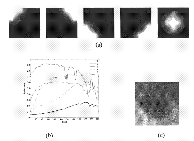
[0159] Artificially generated simulation data are used to test the performance of the algorithm. The ASSNMF proposed by the present invention is compared with the following unmixing algorithms for hyperspectral images: VCA [9], PSNMFSC [10] with spectrum and abundance smoothness and abundance sparsity constraints, and minimum volume constraints The MVCNMF [11]. Among them, VCA can only get the spectral matrix, and other methods can directly solve the spectrum and abundance from the data. For VCA, the present invention uses the FCLS algorithm [8] on the basis of the spectrum it solves to obtain the corresponding abundance, and this method is recorded as VCA-FCLS.
[0160] The present invention uses two indexes of spectral angular distance (Spectral Angel Distance, SAD) and root mean square error (Root Mean Square Error, RMSE) to measure the pros and cons of the unmixing result. These two indicators are used to measure the approximation of the spec...
Embodiment 2
[0174] Embodiment 2 Actual data experiment
[0175] Three actual hyperspectral remote sensing image datasets are used to test the performance of the proposed algorithm.
[0176] The first dataset is the Indiana data captured by the Airborne Visible / Infrared Imaging Spectrometer (AVIRIS). It was imaged in June 1992. The imaging area is the Pine remote sensing test site in Indiana, USA. The data has 220 bands, the wavelength range is from 0.4:2.5μm, the spectral resolution is 10nm, and the spatial resolution is 17m. The image size used in the experiments is 145×145. This data has been widely used in the research and comparison of hybrid pixel decomposition algorithms for remote sensing images. Purdue University has given a field survey report on the area [12]. This area is a piece of farmland located about 10km northwest of West Lafayette, IN, Indiana. The area is mainly covered by various crops (about two-thirds, including corn, wheat, soybeans, haystacks) and natural veget...
PUM
 Abstract
Description
Claims
Application Information
 - R&D
- Intellectual Property
- Life Sciences
- Materials
- Tech Scout
- Unparalleled Data Quality
- Higher Quality Content
- 60% Fewer Hallucinations
Browse by: Latest US Patents, China's latest patents, Technical Efficacy Thesaurus, Application Domain, Technology Topic, Popular Technical Reports.
© 2025 PatSnap. All rights reserved.Legal|Privacy policy|Modern Slavery Act Transparency Statement|Sitemap|About US| Contact US: help@patsnap.com


