Oil and gas field video monitoring intervisibility and regional intervisibility network analysis system and method, equipment and storage medium
A technology of video monitoring and analysis method, which is applied in the field of oil and gas field video monitoring and regional video network analysis, and oil and gas field video monitoring and regional video network analysis system field, which can solve the problem of inaccurate judgment of marking points and inability to block blind areas of vision. It can deal with problems such as the inability to measure multiple markers at the same time, so as to save investment costs and reduce the blind spot of visual monitoring.
- Summary
- Abstract
- Description
- Claims
- Application Information
AI Technical Summary
Problems solved by technology
Method used
Image
Examples
specific Embodiment approach 1
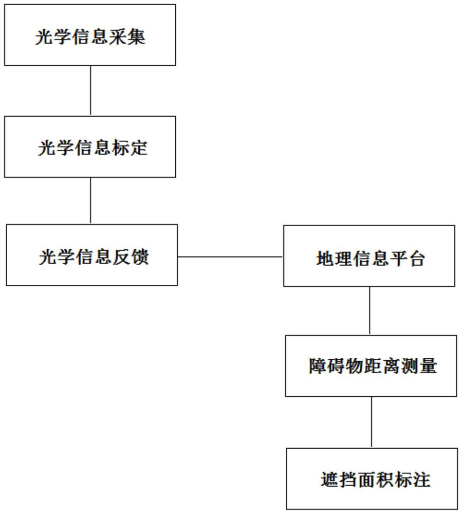
[0035] Specific implementation mode 1: An oil and gas field video monitoring communication and regional communication network analysis system includes two parts: a servo turntable optical monitoring device and a geographic information platform; wherein the servo turntable optical monitoring device includes an optical information collection module, an optical information calibration module, an optical Information feedback module; geographic information platform includes distance measurement module and area labeling module; optical information acquisition module includes collecting high-definition satellite ground image map and position of servo turntable optical monitoring equipment; optical information calibration module calibrates and generates data collected by optical information acquisition module Data matrix; the optical information feedback module sends the calibrated data to the geographic information platform; finally, the data is analyzed through the geographic informat...
specific Embodiment approach 2
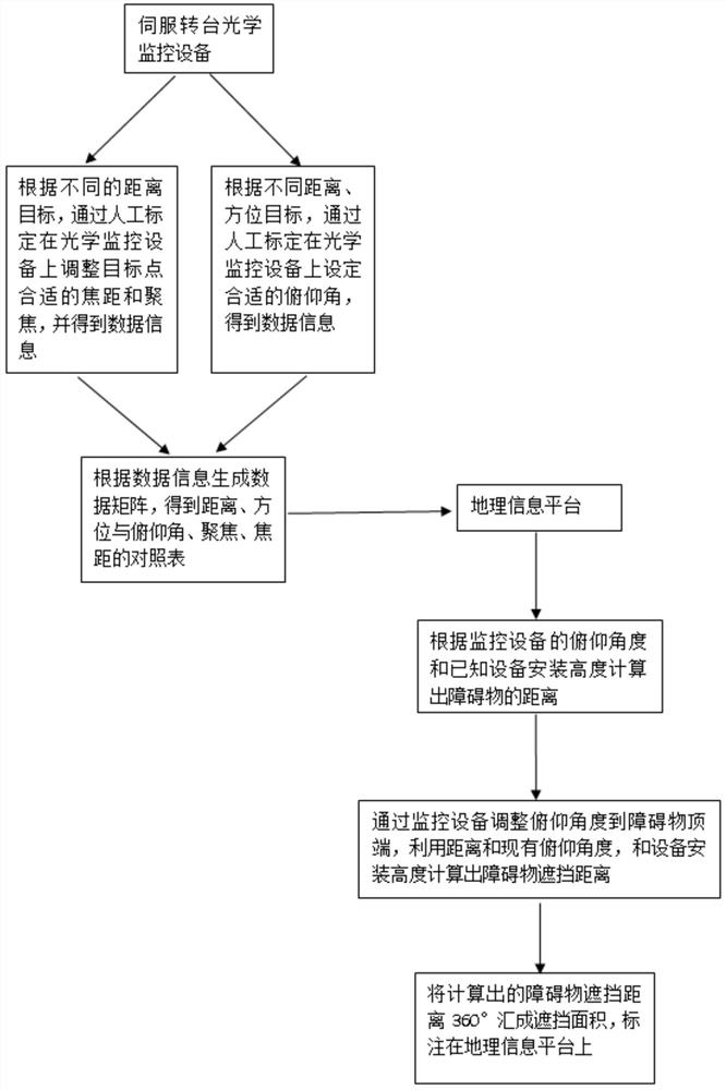
[0036] Specific implementation mode two: a kind of oil and gas field video surveillance communication and regional communication network analysis method, such as Figure 2-Figure 4 shown, including the following steps:
[0037] Step a, configure the high-definition satellite ground image map of the monitored area;
[0038] Step b, adding the installation position and installation height of the servo turntable optical monitoring equipment to the high-definition satellite ground image map in step one;
[0039] Step c, establishing a data matrix of azimuth, distance, and pitch based on the 360-degree equal division of the installation position of the servo turntable optical monitoring equipment;
[0040] Step d, calculate the distance of the occluder according to the azimuth-distance-pitch matrix;
[0041] Step e, adjust the servo turntable optical monitoring equipment, adjust the top of the occluder to the middle of the screen, and calculate the distance of the occlusion surfa...
PUM
 Abstract
Description
Claims
Application Information
 - R&D
- Intellectual Property
- Life Sciences
- Materials
- Tech Scout
- Unparalleled Data Quality
- Higher Quality Content
- 60% Fewer Hallucinations
Browse by: Latest US Patents, China's latest patents, Technical Efficacy Thesaurus, Application Domain, Technology Topic, Popular Technical Reports.
© 2025 PatSnap. All rights reserved.Legal|Privacy policy|Modern Slavery Act Transparency Statement|Sitemap|About US| Contact US: help@patsnap.com


