

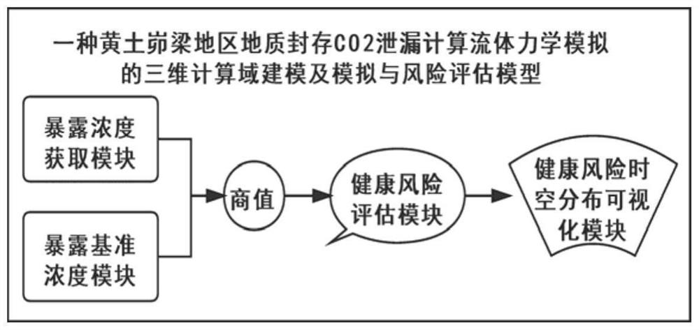
Complex terrain CFD computational domain modeling method and geological sequestration carbon dioxide leakage simulation and risk assessment system
A technology of complex terrain and modeling methods, applied in the field of carbon neutralization and carbon peaking, it can solve the problems of complex diffusion simulation modeling, low visibility and popularity of risk characterization, and unobjective risk assessment standards, and achieve simple calculation. , high applicability and promotion, reliable data effect
- Summary
- Abstract
- Description
- Claims
- Application Information
AI Technical Summary
Problems solved by technology
Method used
Image

Examples
Embodiment Construction
[0035] The present invention will be described in detail below in conjunction with the accompanying drawings.
[0036] The complex terrain CFD computational domain modeling method comprises the following steps:
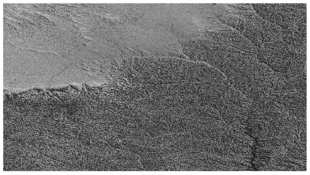
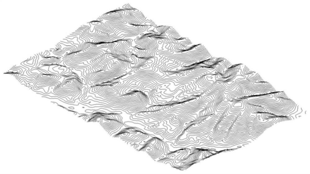
[0037] (1) Obtain the topographic image data of the storage area and the nearby preset range. The source data of the topographic image is the V3 version of ASTERGDEM remote sensing satellite data. The spatial resolution of the data is 30m, and the format is tiff. Refer to figure 2 . Import the terrain image source data into the Global Mapper (Blue Marble Geographic Inc.v.19) software, set the model coordinate system and projection standard according to the regional longitude and latitude and the coordinate system of the image source data, and use the "draw" command to delineate the outer boundary of the study area ; Utilize the "Analyze" and "Generate Contour Based on TIN" commands to generate the 3D contour model of the area to be studied; use "Export" and "Vector ...
PUM
 Abstract
Description
Claims
Application Information