Seawater pollution area identification method and device based on high-resolution remote sensing image

A seawater pollution and remote sensing image technology, which is applied in the field of seawater pollution area identification, can solve problems such as lack of connection, high requirements for computing equipment, and huge capital investment, and achieve the effect of small amount of calculation, exquisite method, and improved efficiency

Active Publication Date: 2020-02-07
BEIJING UNIV OF CIVIL ENG & ARCHITECTURE
View PDF4 Cites 7 Cited by
  • Summary
  • Abstract
  • Description
  • Claims
  • Application Information

AI Technical Summary

Problems solved by technology

However, in these methods, there are constraints such as the large amount of calculation of the convolutional layer of the deep learning convolutional neural network model, high requirements for computing equipment, huge capital investment, and the need for guidance from professional and technical personnel; and the Grab-Cut image segmentation algorithm focuses on solving the original There are problems such as the accuracy of the remote sensing image algorithm segmentation scale and level, the lack of the "segmentation-classification" link, and the lack of discussion on the classification and identification of specific pollutants

Method used


Image

  • Seawater pollution area identification method and device based on high-resolution remote sensing image
  • Seawater pollution area identification method and device based on high-resolution remote sensing image
  • Seawater pollution area identification method and device based on high-resolution remote sensing image

Examples


Embodiment Construction

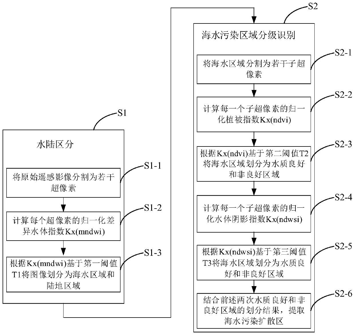
[0039] The technical solution of the present invention will be further described below in conjunction with the accompanying drawings.

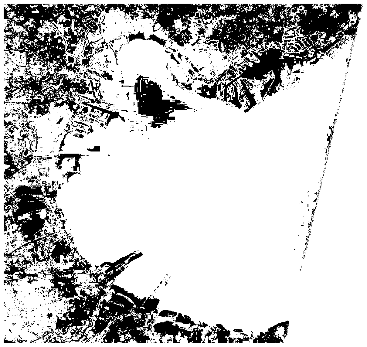
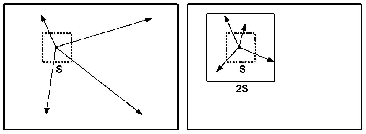
[0040] The method of the present invention first uses a supervised learning algorithm to automatically classify remote sensing images of sea and land, and through process-based iterative clustering, the classification results can reach a higher level of accuracy. Then, using the chlorophyll concentration difference between the marine polluted area and the surrounding seawater and the brightness difference of the pollutant shadow, the normalized normalized vegetation index (NDVI) related to chlorophyll and the normalized shadow related to brightness in remote sensing interpretation Index (NDWSI), the idea of ​​image interpretation based on segmentation and the saliency mechanism based on human vision are combined, and then the extraction of marine polluted areas is realized through threshold segmentation. refer to figure 1 , in one embodiment,...


PUM


Abstract

The invention discloses a seawater pollution area identification method and device based on a high-resolution remote sensing image, and belongs to the field of digital image processing. The method comprises: firstly, performing sea-land automatic classification on remote sensing images through a supervised learning algorithm, a classification result can reach a high precision level through processiterative clustering, and meanwhile, compared with an existing sea-land boundary analysis and classification method, the operand being small; then, using the chlorophyll concentration difference andthe brightness difference of pollutant shadows existing between the marine pollution area and surrounding seawater; combining a normalized vegetation index related to chlorophyll, a normalized water body shadow index related to brightness, a segmentation-based image interpretation thought and a human eye vision-based saliency mechanism in remote sensing interpretation; through threshold segmentation, realizing extraction of a marine pollution area, respectively extracting an area with excellent water quality and a severely polluted area, and further obtaining a pollution transition area. The method provided by the invention provides convenient and accurate reference for marine pollution prevention and treatment.

Description

technical field [0001] The invention belongs to the technical field of digital image processing, and in particular relates to a method and equipment for identifying seawater polluted areas based on high-resolution remote sensing images. Background technique [0002] Today, as the global land resources are increasingly tense and the environment is deteriorating, countries all over the world are turning their attention to the ocean. The development of marine resources and the development of marine economy have become an important pillar of the national economy of coastal countries and the forefront of sustainable development strategies. While modern ocean development brings huge economic benefits, it also brings a series of resources and ecological environment problems. At present, the pollution of the marine environment is becoming more and more serious, and the ecological environment is also becoming worse and worse. Marine economic industries such as marine fishery and mar...

Claims


Application Information

Patent Timeline
Patent Type & Authority Applications(China)
IPC IPC(8): G06K9/00G06K9/34G06K9/62
CPCG06V20/13G06V10/267G06F18/23213G06F18/24G06V20/188G06V10/762G06V10/56G06F18/24137G06T7/11G06T7/136G06T2207/30181G06T2207/10041G06T7/12G06T7/90G06T7/70G06V20/70G06V10/32G06V10/764G06T7/0002G06T2207/10024G06T2207/10032G06T2207/10048G06T2207/20021G06T2207/20081G06T2207/30188
Inventor 张学玲何钰昆李頔李哲
Owner BEIJING UNIV OF CIVIL ENG & ARCHITECTURE
Why Eureka
Try Eureka