Method and device for optimum design of oil field gathering and transportation systems
A technology for optimized design and gathering and transportation systems, applied in the field of geological exploration, to achieve the effect of reducing construction investment and operating costs
- Summary
- Abstract
- Description
- Claims
- Application Information
AI Technical Summary
Problems solved by technology
Method used
Image
Examples
Embodiment 1
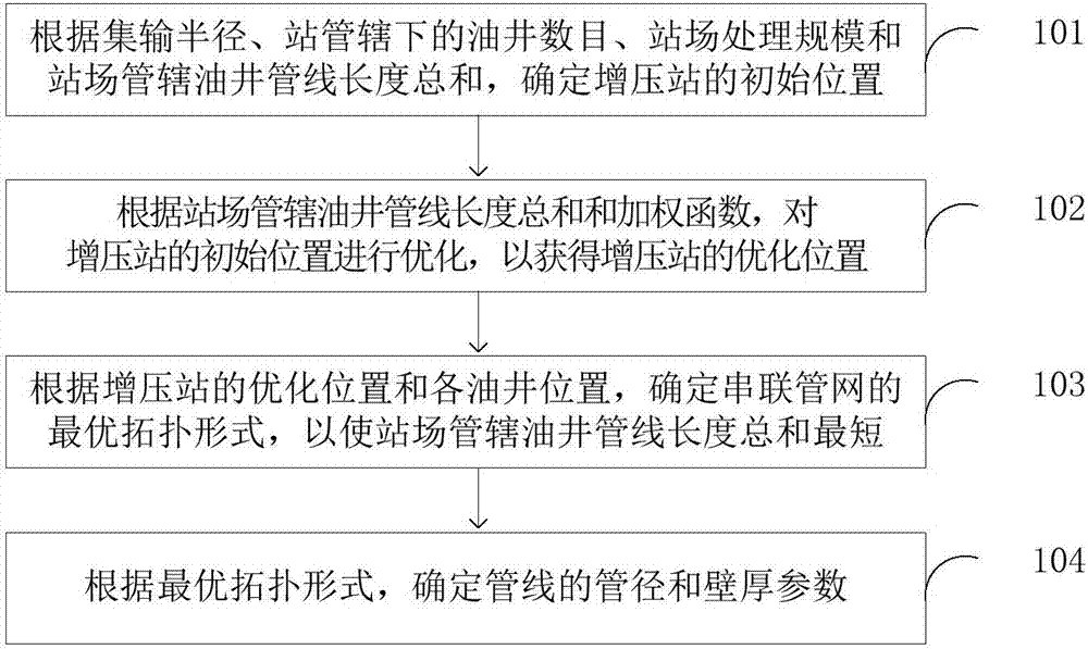
[0052] figure 1 It is a schematic flow chart of an optimal design method for an oilfield gathering and transportation system according to Embodiment 1 of the present invention; figure 1 As shown, this embodiment provides an optimal design method for an oilfield gathering and transportation system, including steps 101-104.
[0053]Among them, in step 101, the initial position of the booster station is determined according to the gathering radius, the number of oil wells under the jurisdiction of the station, the processing scale of the station and the sum of the pipeline lengths of the oil wells under the jurisdiction of the station.
[0054] Specifically, the gathering and transportation radius is generally 2 kilometers or 3 kilometers. The number of oil wells under the jurisdiction of the station is the number of oil wells that need to be boosted by the booster station. The processing scale of the station indicates the scale that the booster station can boost. The premise of...
Embodiment 2
[0063] This embodiment is a supplementary description based on the above embodiments.
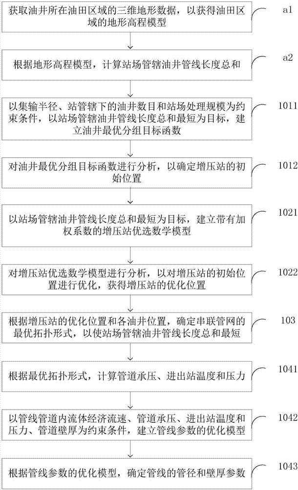
[0064] figure 2 It is a schematic flow chart of an optimal design method for an oilfield gathering and transportation system according to Embodiment 2 of the present invention; as figure 2 As shown, this embodiment provides a method for optimal design of an oilfield gathering and transportation system, including:
[0065] In step a1, the three-dimensional terrain data of the oilfield area where the oil well is located is obtained to obtain a terrain elevation model of the oilfield area. The terrain elevation model (DEM) is obtained by the SRTM system, and the latitude and longitude coordinates of the WGS-84 coordinate system of the ellipsoidal datum are converted into the plane Cartesian coordinates of the National-80 coordinate system of the ellipsoidal datum through coordinate conversion.
[0066] Step a2, according to the terrain elevation model, calculate the total length of oil wel...
Embodiment 3
[0077] This embodiment is an embodiment of a device, which is used to execute the method in the first embodiment above.
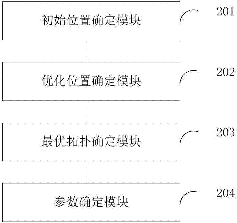
[0078] image 3 It is a structural schematic diagram of an optimized design device for an oilfield gathering and transportation system according to Embodiment 3 of the present invention; as image 3 As shown, this embodiment provides an optimal design device for an oil field gathering and transportation system, including: an initial position determination module 201 , an optimized position determination module 202 , an optimal topology determination module 203 and a parameter determination module 204 .
[0079] Among them, the initial position determination module 201 is used to determine the initial position of the booster station according to the gathering radius, the number of oil wells under the jurisdiction of the station, the processing scale of the station and the length of the oil well pipeline under the jurisdiction of the station;
[0080] The op...
PUM
 Abstract
Description
Claims
Application Information
 - R&D
- Intellectual Property
- Life Sciences
- Materials
- Tech Scout
- Unparalleled Data Quality
- Higher Quality Content
- 60% Fewer Hallucinations
Browse by: Latest US Patents, China's latest patents, Technical Efficacy Thesaurus, Application Domain, Technology Topic, Popular Technical Reports.
© 2025 PatSnap. All rights reserved.Legal|Privacy policy|Modern Slavery Act Transparency Statement|Sitemap|About US| Contact US: help@patsnap.com


