Method for extracting mountain river information

A technology of information extraction and rivers, applied in image data processing, instruments, calculations, etc., can solve the problems of unsystematic removal of mountain shadows and building interference, the accuracy of extraction needs to be improved, and the leakage of small rivers in mountainous areas. Facilitate recognition and extraction, eliminate the effect of mountainous terrain, and facilitate shadow removal

Inactive Publication Date: 2018-09-14
INST OF GEOCHEM CHINESE ACADEMY OF SCI
View PDF2 Cites 17 Cited by
  • Summary
  • Abstract
  • Description
  • Claims
  • Application Information

AI Technical Summary

Problems solved by technology

[0006] The technical problem to be solved in the present invention is: provide a kind of mountainous river information extraction method, to solve existing technology for mountainous river information extraction adopt software such as ENVI and ArcGIS, adopt single-band threshold value method, multi-band spectral relation method, water bod

Method used


Image

  • Method for extracting mountain river information
  • Method for extracting mountain river information
  • Method for extracting mountain river information

Examples


Embodiment Construction

[0034] The invention provides a method for extracting mountain river information, comprising the following steps:

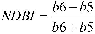
[0035] First, data preprocessing. Preprocessing of Landsat 8OLI (Geospatial Data Cloud (http: / / www.gscloud.cn / )), including radiometric calibration, atmospheric correction, mosaic and clipping. The radiometric calibration process is to convert the gray value of the acquired remote sensing image data into the reflectance of the actual physical meaning. Radiation calibration achieves the goal of eliminating the error generated by the sensor itself by establishing the quantitative relationship between the digital quantization value and the radiance value in the corresponding field of view. Atmospheric correction restores the calibration value to the real information of the surface and ensures that the spectral information of the ground object is restored. The images after atmospheric correction were mosaiced and cropped to determine the scope of the study area.

...


PUM


Abstract

The invention discloses a method for extracting mountain river information. The method comprises the following steps: performing radiation calibration, atmospheric correction, mosaicing and cutting processing on remote sensing image data information of a land satellite Landsat 8 OLI; calculating a composite spectral threshold water index; extracting a mountain shadow of a study area according to DEM data of the study area; extracting a river network of the study area according to the DEM data of the study area, and establishing a river buffer area; calculating the land surface temperature of the study area; calculating surface albedo of the study area; calculating the NDBI (normalized difference build-up index) of the study area; resampling the land surface temperature, surface albedo andNDBI layer of the study area for standard treatment to eliminate incorrectly extracted building information; performing small hole elimination and gap filling on the extracted small rivers in the study area are filled by closed operation and filtering operation in mathematical morphology filtering. The technical problem that accuracy of information extraction for mountain rivers in the prior art needs to be improved is solved.

Description

technical field [0001] The invention belongs to river information extraction technology, in particular to a method for mountain river information extraction. Background technique [0002] Surface water resources are one of the irreplaceable resources for human survival and social development, and are crucial to human beings, crops and ecology. There are many problems in the traditional mountainous river information extraction methods, such as shadows and building interference, which lead to misreporting, overreporting, and missing small water bodies in the river network. These problems affect the investigation of water resources and the protection of ecological environment in mountainous areas. Therefore, it is very urgent to establish an accurate and efficient method for information extraction of mountain rivers. [0003] At present, the data used for mountain river information extraction mainly include: Landsat (Landsat) TM, ETM+ and OLI, high-resolution satellite and ot...

Claims


Application Information

Patent Timeline
IPC IPC(8): G06T7/00
CPCG06T7/0002G06T2207/10036G06T2207/20081G06T2207/30184
Inventor 白晓永李朝君吴路华肖建勇杨钰杰
Owner INST OF GEOCHEM CHINESE ACADEMY OF SCI
Why Eureka
Try Eureka