Orchard planting digital mapping management method and system based on fruit tree coding
A management method and technology of digital maps, applied in data processing applications, character and pattern recognition, special data processing applications, etc., can solve the problems of complex methods, high work intensity, and high use costs
- Summary
- Abstract
- Description
- Claims
- Application Information
AI Technical Summary
Problems solved by technology
Method used
Image
Examples
Embodiment example 1
[0045] A digital mapping management method for orchard planting based on fruit tree coding, comprising the following steps
[0046] S1. Obtain orchard image information, and splicing and synthesizing the acquired orchard images into a large image; this embodiment adopts UAV high-altitude aerial photography technology to obtain complete orchard image information, and the flying height of the UAV can be 60-500 meters. The machine's high-definition camera takes the front view of the park. The captured high-definition pictures are stitched together to synthesize a complete park picture. In this embodiment, the Pix4Dmapper aerial picture stitching tool is used to stitch the aerial pictures, and the high-definition png format composite picture is exported.
[0047] S2. Perform tree crown recognition on the spliced pictures, identify all fruit trees extracted from the pictures, and identify fruit trees through the color difference between the fruit trees and the surrounding environ...
Embodiment example 2
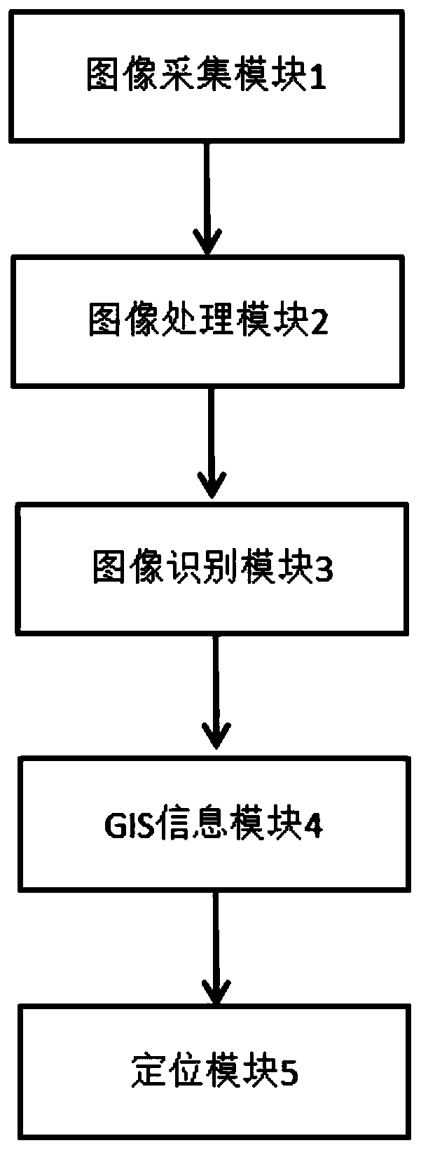
[0058] A digital management system for orchard planting based on fruit tree coding includes an image acquisition module 1 , an image processing module 2 , an image recognition module 3 and a GIS information module 4 electrically connected to each other.
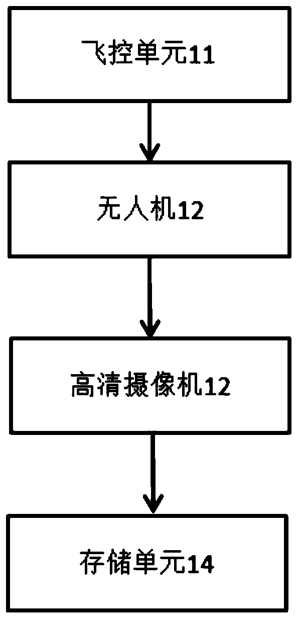
[0059] Image acquisition module 1 uses unmanned aerial vehicle to carry out image acquisition to orchard, obtains the orchard aerial photograph; Aerial photography, the flying height is 60-500 meters, which is convenient for aerial photography. The high-definition camera 12 is used to take pictures of the orthophoto of the park; the flight control unit 11 is used to control the UAV to fly according to the planned route, and the park is completely photographed; the storage unit 14 Used to store aerial image information.
[0060] The image processing module 2 is used for cutting and splicing the clear orchard aerial image into a finished large image of the orchard; the synthetic orchard large image is a high-definition picture ...
PUM
 Abstract
Description
Claims
Application Information
 - R&D
- Intellectual Property
- Life Sciences
- Materials
- Tech Scout
- Unparalleled Data Quality
- Higher Quality Content
- 60% Fewer Hallucinations
Browse by: Latest US Patents, China's latest patents, Technical Efficacy Thesaurus, Application Domain, Technology Topic, Popular Technical Reports.
© 2025 PatSnap. All rights reserved.Legal|Privacy policy|Modern Slavery Act Transparency Statement|Sitemap|About US| Contact US: help@patsnap.com


