This is unnecessary and the communications can be general since the amount of information that is unique to one vehicle is small.
However, the author (unnecessarily) complicates matters by using
push technology which isn't absolutely necessary and with the belief that
the Internet connection to a particular vehicle to allow all vehicles to communicate, would have to be stopped which, of course, is not the case.
DSRC could be used for inter-vehicle communications, however, its range according to the ITS proposal to the Federal Government would be limited to about 90 meters although there have been recent proposals to extend this to about 1000 meters.
Also, there may be a problem with interference from
toll collection systems, etc.
This would not be sufficient for the RtZF™
system.
Fifty meters amounts to about one second, which would be insufficient time for the passing vehicle to complete the passing and return to the safe lane.
This, however, may interfere with other uses of DSRC such as automatic
toll taking, etc., thus DSRC may not be the optimum communication
system for communication between vehicles.
“Automotive suppliers cannot sell infrastructure-dependent systems to their customers until the very large majority of the infrastructure is suitable equipped.”
It relies on many papers and patents in the prior art but does not explain how any of these prior art ideas would be implemented.
For example it does not
handle the problem of obstructions or potential collisions when
visibility is poor since there is virtually no general illumination provided, especially in the IR portion of the spectrum, and
radar is generally not capable of providing images that can be segmented, analyze and identified.
Furthermore, without accurate maps, it is unlikely that run-off-the-road situations,
stop sign infractions, stoplight infractions or collisions with systems that do not have the Lemelson
system and thus cannot communicate their positions and velocities to the host vehicle can be solved.
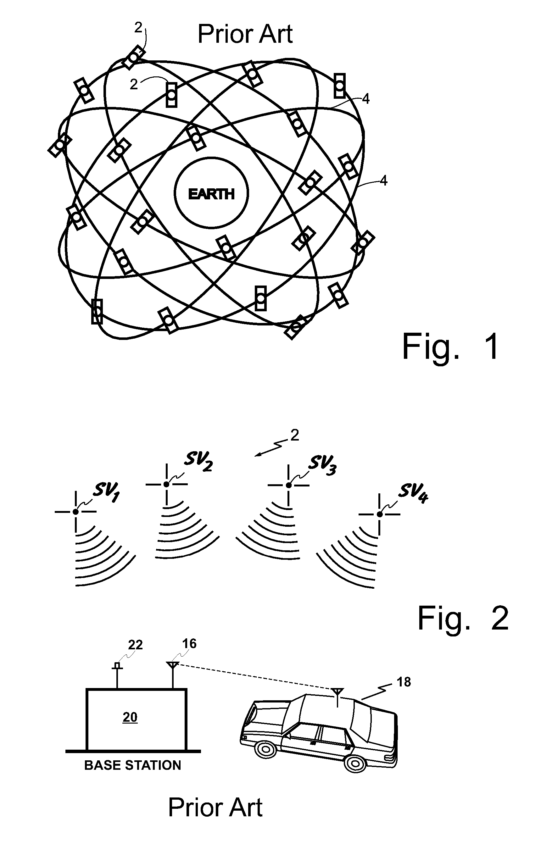
The system relies completely on multiple antennas receiving
GPS signals which are notoriously poor in urban settings.
Thus, the deployment of pseudolites is totally impractical.
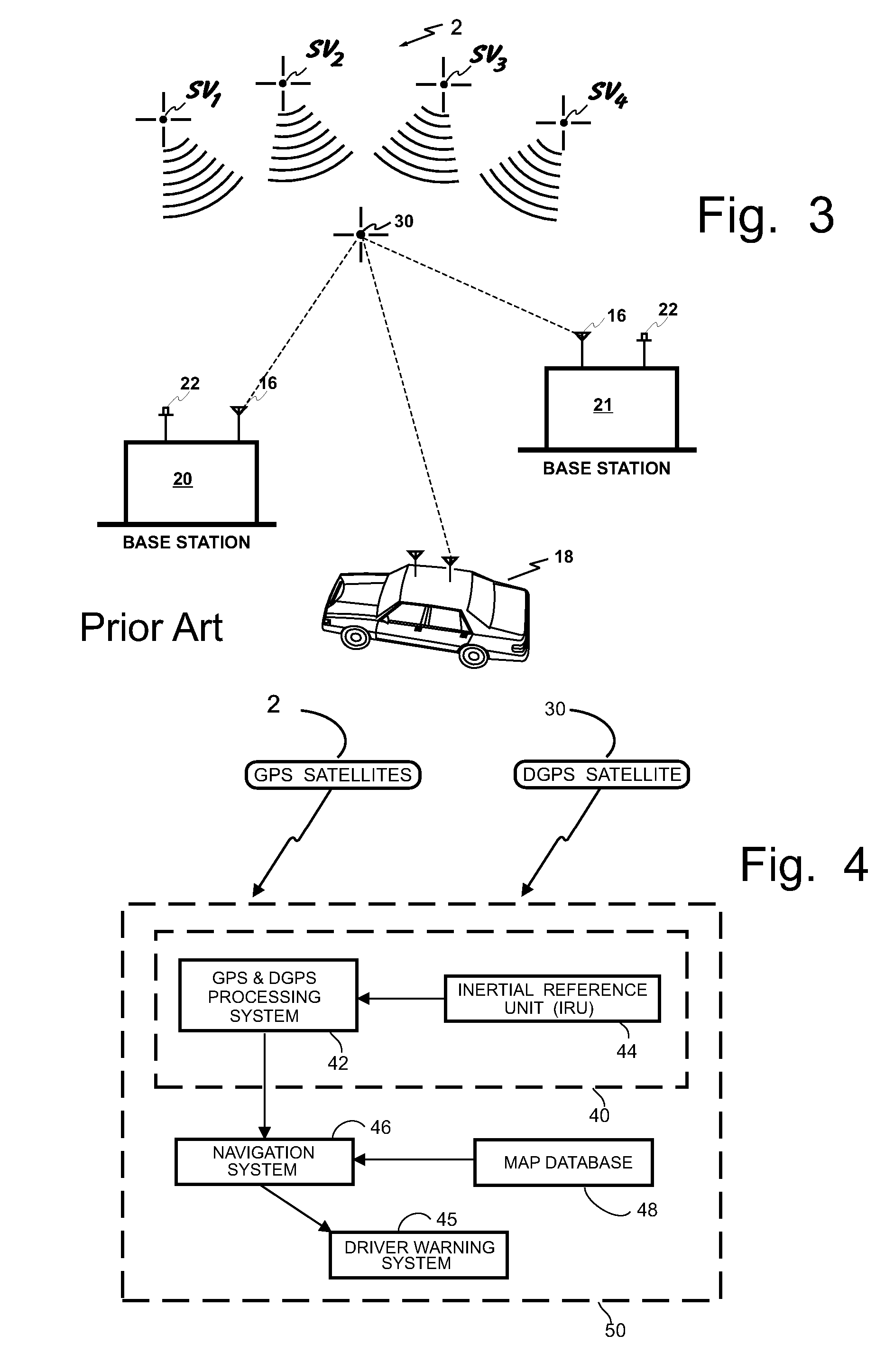
Similarly, use of local area
differential GPS corrections is impractical since a system would need to be placed approximately every roughly 30 to 60 miles across the entire United States.
Although Lemelson speaks of using neural networks to identify objects in an image, this is not easily accomplished unless three-dimensional data is available.
Stereo photography only works when the device being imaged is near to the host vehicle and thus this system cannot be used to segment objects that are more than about ten meters from the vehicle.
Thus, three-dimensional information on most objects is not available.
Furthermore, obtaining three dimensions from
stereo cameras is a computationally intensive activity.
In short, Lemelson is not likely to be enabling of any practical GPS vehicle collision avoidance warning and
control system and method.
For example, prior to the filing date of the '452 provisional patent application, there were not believed to be any viable vehicle-to-vehicle communication systems available, except as provided by Automotive Technologies International, Inc.
(ITI), nor were there any vehicle-to-infrastructure communication systems believed to be available other than using
cell phones.
Atomic clocks would not be installed and thus these stations could not act as pseudolites.
Since the vehicle does not know where the highway is, except perhaps crudely in good weather, it cannot locate itself on the highway.
Such errors are caused by multipath which results whenever the vehicle does not have a
line of sight path to the pseudolites.
Thus, the inter-vehicle communication system described in Lemelson is unworkable and therefore not enabled.
However, it is well known that differentiating a
signal results in a significant loss in accuracy.
Thus, to obtain an
angular velocity from the angular position determination is possible but it will have a substantial error.
To use this system to predict a
rollover or skidding condition is possible but error prone to false positives.
Note that television by itself implies using the visual part of the
electromagnetic spectrum which may work on a nice clear day but has serious problems in rain,
snow,
smoke or
fog and at night without illumination.
Radar scanning by physically moving the antenna is very costly and slow and thus not practical for surround vehicle scanning.
Thus there is no enabling disclosure that would permit the Lemelson system to detect obstacles, people, bicycles, animals, signs,
terrain, roadway features and turns or the like.
Although the vehicle in Lemelson does not maintain its own map, it does obtain the location of all hazardous objects from the control center.
Needless to say this would be a massive and impractical method of communicating map features to a vehicle for all vehicles in the vicinity.
The communication system proposed in Lemelson is difficult to understand.
If the control
tower is fifty miles away then thousands of vehicles can be within a fifty
mile radius of the host vehicle resulting in a massive amount of communication which undoubtedly would exceed the available bandwidth for many places in the US.
This can be reduced by providing control towers which are closer together however, since each control
tower is a
pseudolite with an
atomic clock, the cost of this implementation would be prohibitive.
Although an FM and AM radio
tuner can literally receive hundreds of stations it can only effectively listen to one at a time.
Presumably, a large hardware installation at a
pseudolite could house such hardware to listen to thousands of vehicles simultaneously but the cost of such an installation would be high.
However, this cannot be used to aid in the segmentation process so it is unlikely that such a system will be used.
An
atomic clock would clearly render the
pseudolite prohibitively expensive to be used in the manner in which Lemelson suggests.
However, the GPS equations only allow you to determine your location within some number of meters.
Although new clocks are being developed which approach atomic
clock accuracies at much less expense, these were certainly not available nor contemplated in 1993.
Therefore, for a pseudolite to be able to transmit a PNR that is of comparable integrity as from a
satellite in 1993 would require the presence of an atomic
clock thus rendering this device impractical and thus the entire Lemelson system is not capable of being enabled as described.
Thus the method of measuring distance to the object cannot be used as a method of segmenting objects within an image.
It would be virtually impossible in 1993 to look at the image containing multiple vehicles and to analyze that whole image in one neural network.
However, it fails to compare this with the road that the driver is driving on and thus what might be erratic driving on a smooth highway could be very normal driving on a country road with potholes, for example, in this case the driving would seem to be highly erratic and give many false positives.
Although many have proposed such a network, until now there has been no enabling reason why it should be adopted.
U.S.
Patent Application Publication No. 20040014463 illustrates a poor method of updating a non-vehicle
database through the use of data-encoded audio CDs.
This system would be too slow for the invention herein especially if it took place over the
cell phone network.
Their problem is that the GPS according to the '233 patent is only accurate to one hundred meters and that is not sufficiently accurate in many cases for the
route guidance system of the '233 patent.
Another cause is errors in the system's map of the road network.
This again cannot happen or use of systems herein would result in accidents.
Another cause is inaccuracy in estimating the distance traveled by the vehicle which again could not happen in systems described herein.
Sending and receiving of such messages requires that the
truck driver stop his vehicle, thus
wasting valuable time.
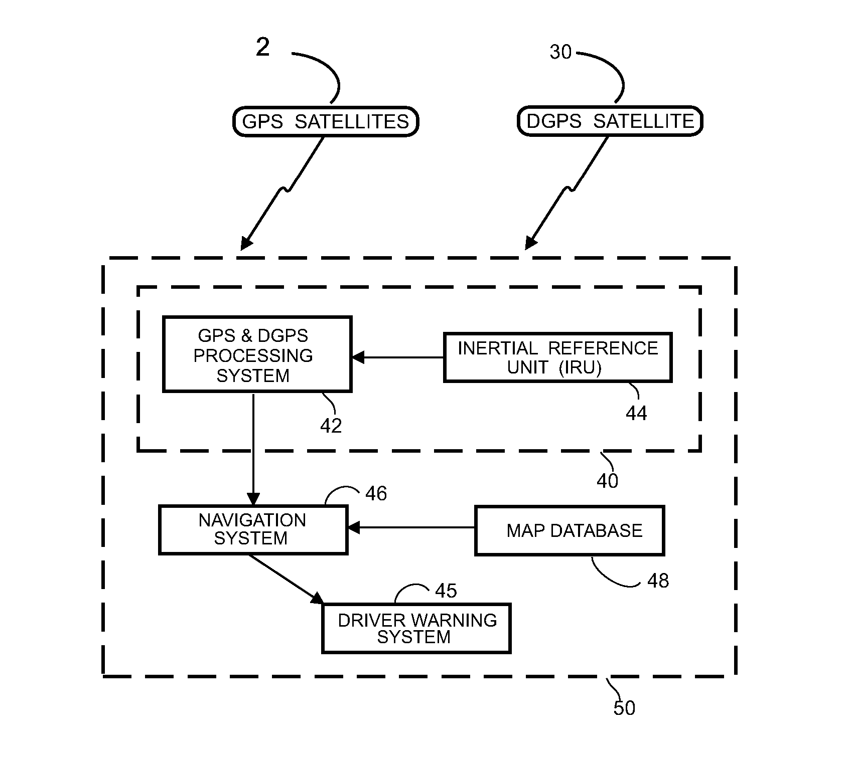
Additionally, no prior art system is believed to have successfully used the GPS
navigational system, or an augmented DGPS to locate a vehicle on a roadway with sufficient accuracy that that information can be used to prevent the equipped vehicle from leaving the roadway or striking another similarly equipped vehicle.
Prior art systems in addition to being poor at locating potential hazards on the roadway, have not been able to ascertain whether they are in fact on the roadway or off on the side, whether they are threatening vehicles, static signs, overpasses etc.
In fact, no credible attempt to date has been made to identify or categorize objects which may
impact the subject vehicle.
Sometimes the data upon which the system is trained is sufficiently complex or imprecise that different views of the data will give different results.

