

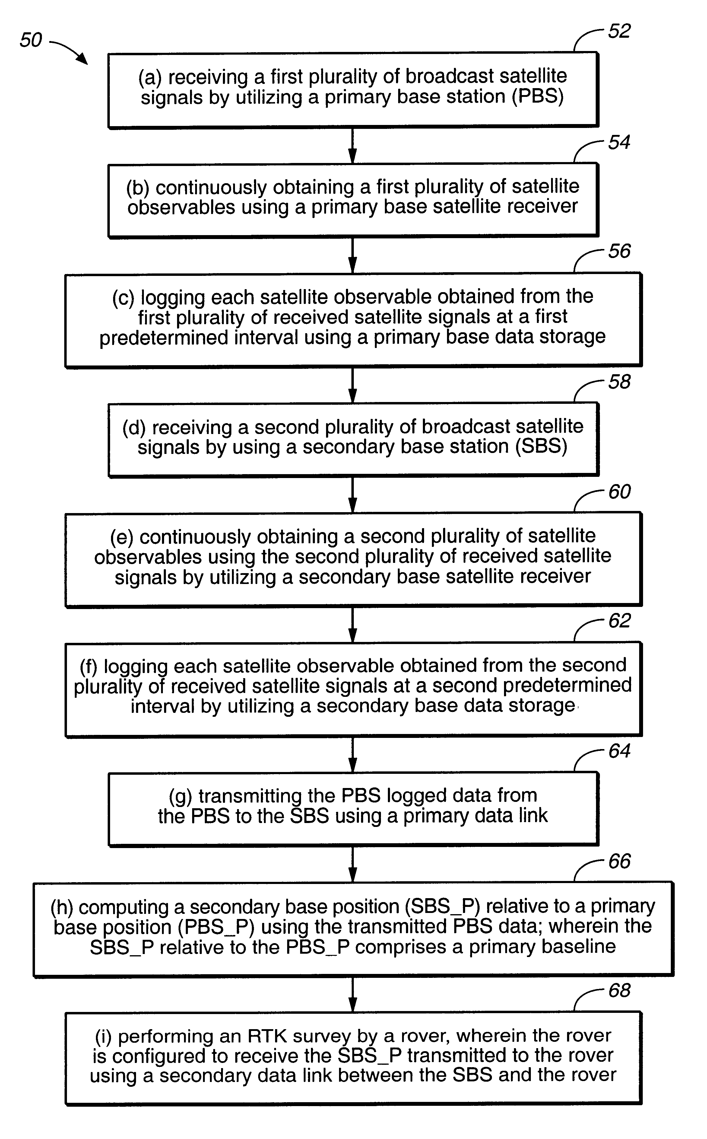
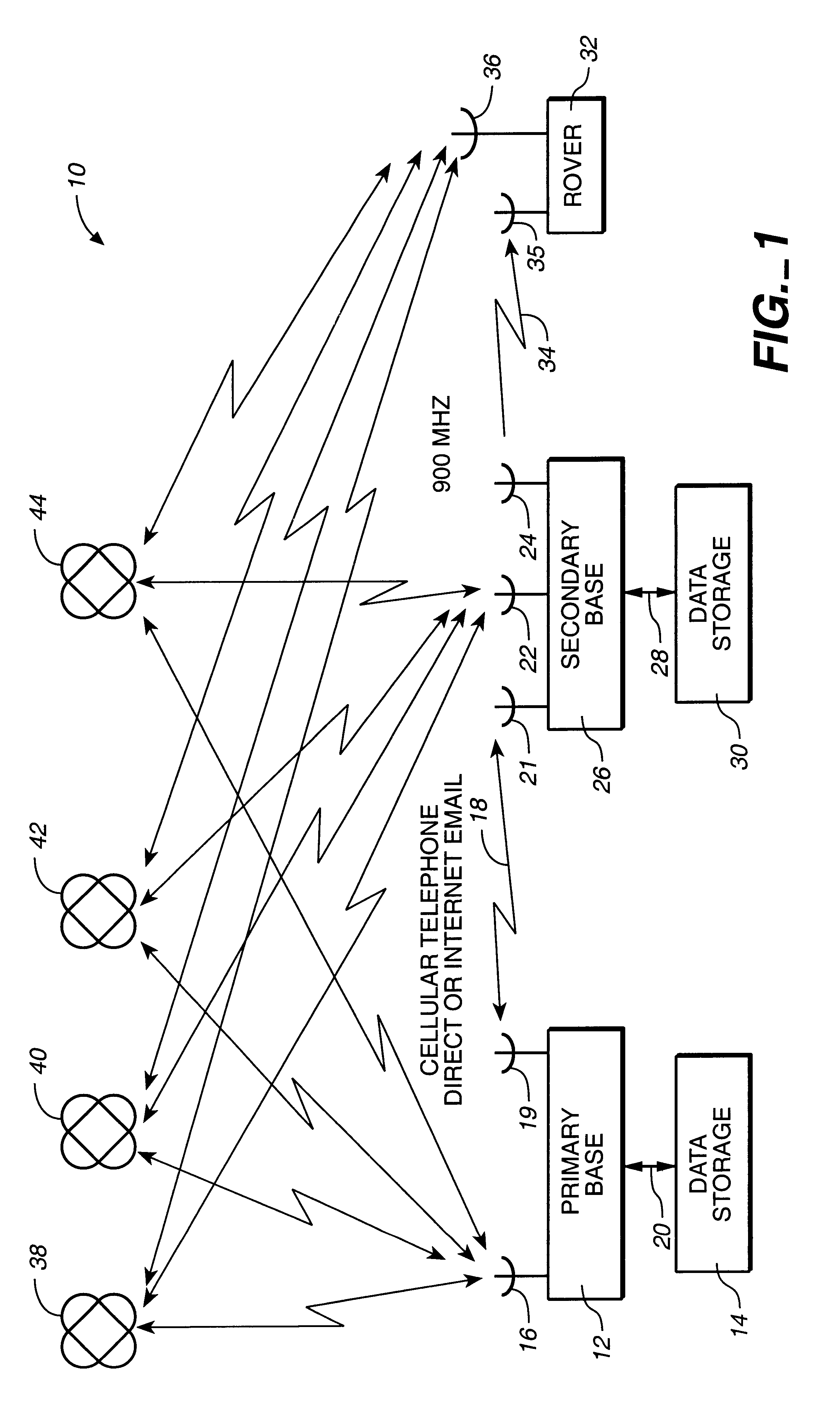
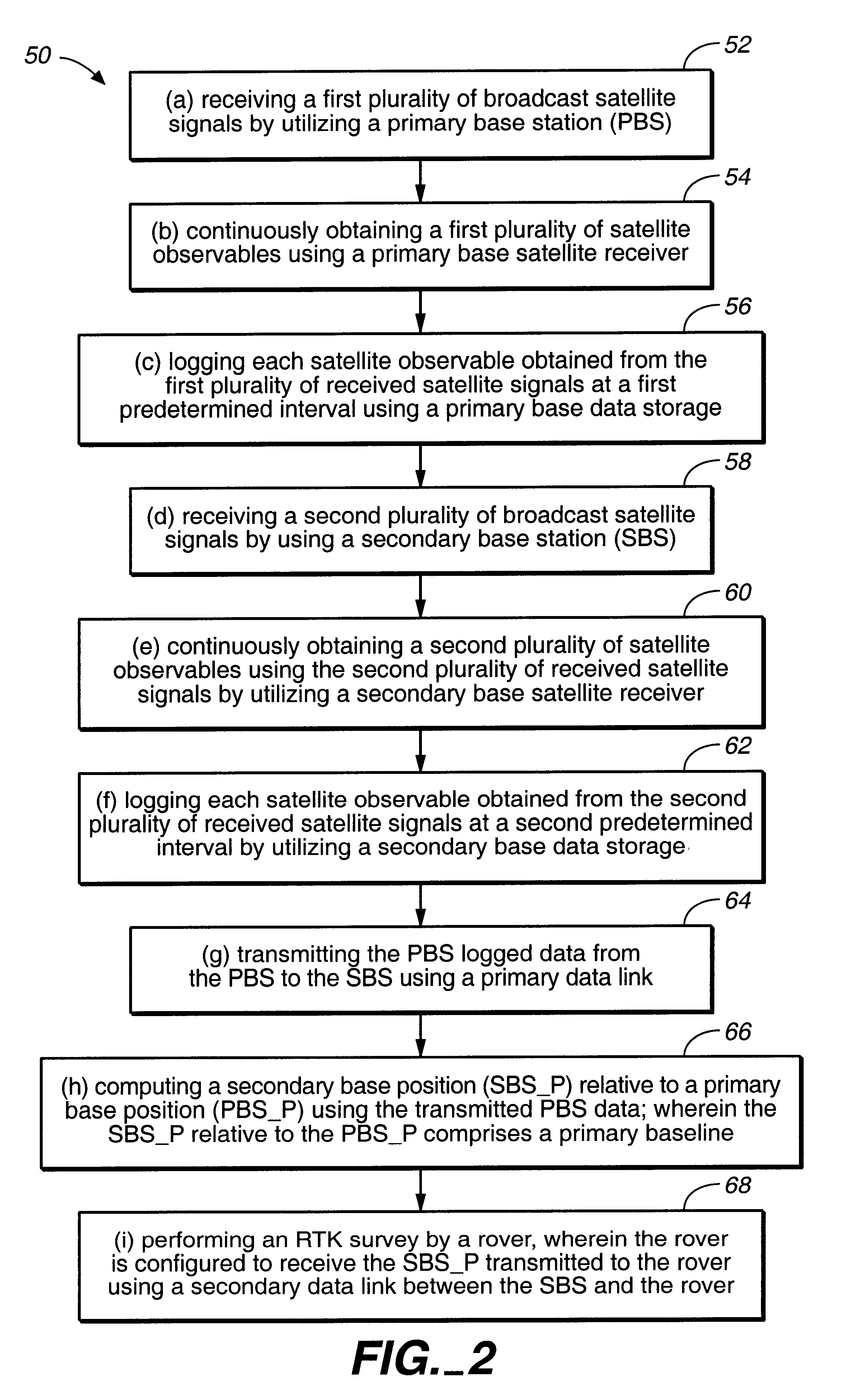
Long baseline RTK using a secondary base receiver a non-continuous data link and a wireless internet connectivity
- Summary
- Abstract
- Description
- Claims
- Application Information
AI Technical Summary
Benefits of technology
Problems solved by technology
Method used
Image

Examples
first embodiment
In an auto-selection program, the auto-selection program of the '306 patent first examines all the PBS logged data for start and end times. Using the start and end times, the auto-selection program determines the relevant time spans during which sufficient PBS data has been logged.
Once the time spans needed for logged PBS data have been determined, the time is transformed into Universal time. Finally, the auto-selection program generates one or more coded file names that should contain the needed logged PBS data.
In one embodiment, the PBS DGPS error correction data files are each stored for one hour increments, thus there are 24 error correction files generated each day. The file name of each error correction file identifies the time span for which the error correction file is valid. Specifically, the file name is in the form YYMMDDHH.SSF where the first two characters of the file name (YY) identify the year; the next two characters (MM) identify the month; the next two characters (...
second embodiment
In an auto-selection program, according to '306 patent, the auto-selection program also examines all the uncorrected GPS files for start and end times to determine the time spans needed for correction. Then, the auto-selection program examines all the files in a local directory containing a set of DGPS error correction files to determine their start and end times. In one embodiment, the auto-selection program recursively examines all subdirectories. By comparing the time spans needed for correction with the available DGPS error correction files, the auto-selection program determines which error correction files of the available files should be used. The auto-selection program is optimized to look at files ending with the suffixes ".SSF" and ".DAT" first. Furthermore, the auto-selection program rejects rover data files that look similar to DGPS error correction files.
If the auto-selection program determines that there is some duplicate coverage, for instance, when there is a pluralit...
PUM
 Abstract
Description
Claims
Application Information