A method for estimating bridge and culvert structure based on Mayi River basin

A technology for bridges and culverts and watersheds, applied in the field of bridge and culvert structure calculations, can solve problems such as unreasonable distribution of bridge and culvert construction locations, affecting the quantitative research process of cold-water fish in the Ant River Basin, etc.

Active Publication Date: 2019-03-15
BEIJING NORMAL UNIVERSITY
View PDF4 Cites 2 Cited by
  • Summary
  • Abstract
  • Description
  • Claims
  • Application Information

AI Technical Summary

Problems solved by technology

[0004]The purpose of this invention is to solve the problem that the location distribution of bridges and culverts is unreasonable and affects the quantitative research process of cold-water fish migration in Ant River Basin affected by bridges and culverts. A bridge and culvert structure calcu

Method used


Image

  • A method for estimating bridge and culvert structure based on Mayi River basin
  • A method for estimating bridge and culvert structure based on Mayi River basin
  • A method for estimating bridge and culvert structure based on Mayi River basin

Examples


Embodiment 1

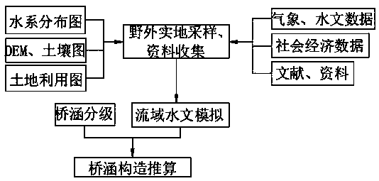
[0053] A bridge and culvert structure calculation method based on Ant River Basin, comprising the following steps:

[0054] S1. Collect the basic data of the Ant River Basin, consult the hydrological yearbook and literature to collect daily flow and water temperature data, and download the spatial data of the Ant River Basin from the scientific data website. The spatial data include DEM elevation data, soil data and land use data. Investigate the structural data of small tributary bridges and culverts, which include the distribution location, type, span, length, and slope of bridges and culverts;

[0055] S2. Construct the SWAT hydrological model of the small watershed and the Ant River Basin, including vector analysis of DEM elevation data, editing of soil and land use vector data attribute tables, editing index meteorological data, division of hydrological response units, and calibration and verification of SWAT hydrological models ,

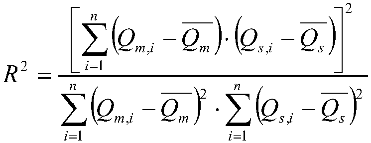
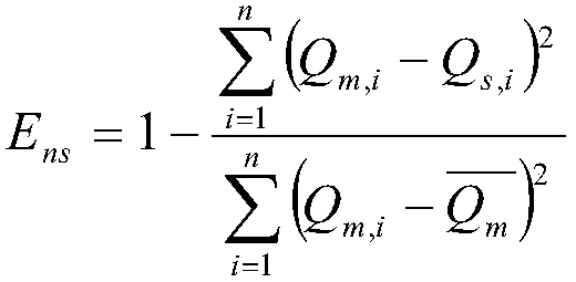
[0056] The linear regression equation ...

Embodiment 2

[0093]This program first combines the collected basic data to construct the SWAT hydrological model of the Ant River Basin, uses the hydrological data to calibrate and verify the SWAT hydrological model, and obtains the daily flow data of the small watershed. The construction of the SWAT model is completed on the ArcGIS platform, which needs to input DEM elevation data, land use data, soil data, rainfall, temperature, radiation, humidity, wind speed and other data; the calibration and verification of the model use SWAT-CUP software, manual and Combining automatic calibration methods to obtain the best combination of parameters; only simulated flow data are used in this study, so the calibration of daily flow is mainly focused, and sediment and nutrients are not considered. The main steps are as follows:

[0094] Step 1: Input the DEM elevation data. The DEM elevation data adopts the SRTMDEM 90M resolution elevation data, which is jointly measured by NASA and the National Bureau...

Embodiment 3

[0118] Refer to the "Technical Standards for Highway Engineering JTGB01-2014" and "Code for Design of Highway Bridges and Culverts JTGD60-2004", and combine the SWAT model simulation to obtain the flood peak flow to calculate the bridge and culvert structure.

[0119] Step 1: Calculate the design flow of the bridge and culvert, the formula is as follows:

[0120] Q xs =M·Q x

[0121] Among them, M cycle conversion coefficient, this scheme is based on the 25-year flood, which needs to be converted into a 50-year flood, so that the known frequency is p 1 When the cycle conversion factor of 1 is 1, check the table below to get the cycle conversion factor when the specified frequency is p, which is 1.33.

[0122]

[0123] Step 2: Superimpose the road and water system layers to obtain the culvert distribution position, and determine the culvert type and culvert length through the following two tables.

[0124]

[0125]

[0126] Step 3: Calculate the span of the bridge ...


PUM


Abstract

The invention discloses a method for estimating bridge and culvert structure based on Mayi river basin, belonging to the field of hydrology environment. Including the establishment of SWAT hydrological model and the calculation of bridge and culvert structure, using hydrological data to calibrate and verify the model, to obtain daily discharge data of small watershed, Within a relatively large watershed, it is difficult to investigate the structure of bridges and culverts, The selection and construction of bridges and culverts by means of bridge and culvert structure estimation and the selection of appropriate types of bridges and culverts can provide theoretical support for river ecological management decision-making, provide reasonable distribution for future bridge and culvert construction, and also provide convenient operation for studying the quantification process of cold water fish migration affected by bridges and culverts in Mayi River Basin.

Description

technical field [0001] The invention relates to the field of hydrology, in particular to a method for calculating bridge and culvert structures based on the Ant River Basin. Background technique [0002] The role of river and stream ecosystems in modern watershed management is becoming more and more important. Rivers and water systems are an important component of the global hydrological cycle. Reasonable development of water resources is the support for the development of the entire social civilization. In the context of global climate change and increased human disturbance, the health of river and stream ecosystems deserves attention. Since the 1970s, under the dual influence of climate change and human activities, major changes have taken place in the water system structure and connectivity pattern of the river network, that is, the decline of the river network water system and the obstruction of connectivity. The decline of resource carrying capacity, the deterioration ...

Claims


Application Information

Patent Timeline
IPC IPC(8): G06F17/50
CPCG06F30/20Y02A10/40
Inventor 陈贺邢宝秀
Owner BEIJING NORMAL UNIVERSITY
Why Eureka
Try Eureka