Evaporation waveguide monitoring diagnosing evaluating method and device
A technology of evaporative waveguide and radar, which is applied in the field of evaporative waveguide monitoring, diagnosis and evaluation methods and devices, and can solve problems such as difficult to achieve, continuity of hydrometeorological parameters, poor real-time performance, and low degree of automation
- Summary
- Abstract
- Description
- Claims
- Application Information
AI Technical Summary
Problems solved by technology
Method used
Image
Examples
Embodiment 1
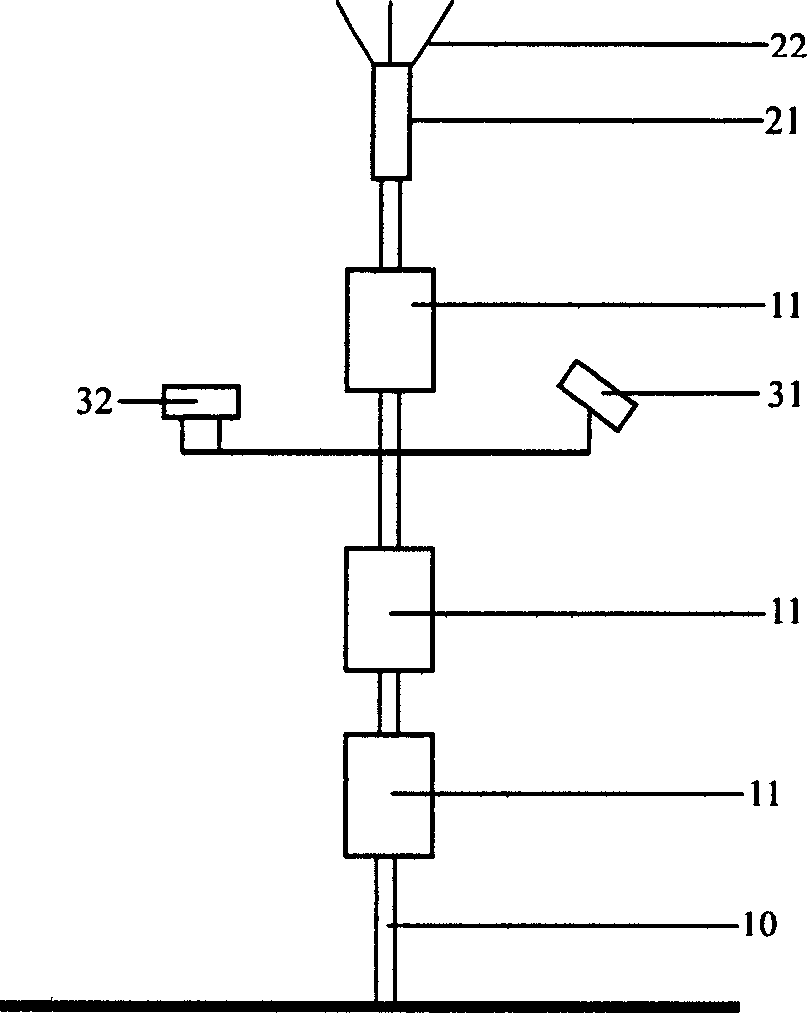
[0079] In order to evaluate the impact of the evaporation waveguide on radar detection, the Dalian Naval Academy of the Navy monitored and diagnosed the evaporation waveguide on the side of the south pier (λ121°39.8'E 38°51.8'N) of Dalian 760 Research Institute, and evaluated the impact of the 1290 radar on the evaporation waveguide. The maximum detection distance under the conditions, adopted the evaporation waveguide monitoring diagnosis evaluation method and device of the present invention in the test, and its use and operation procedures are as follows:
[0080] When monitoring, diagnosing and evaluating the evaporation waveguide on the coast, install the bracket on the wharf 2 meters away from the sea. The infrared sea surface temperature sensor [31] and the GPS receiver [32] are installed, and the installation heights of multiple sensors are respectively: the temperature and humidity sensor in the lower layer [11] is 3 meters above the average sea surface height, and the...
Embodiment 2
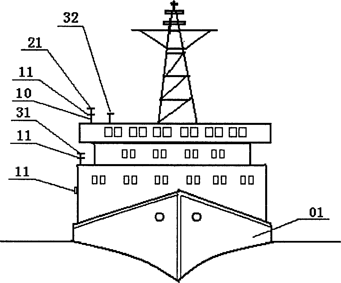
[0086] In order to verify the correctness of the evaporative waveguide monitoring and diagnostic evaluation method and device diagnostic evaluation of the present invention, the XX army installed an evaporative waveguide monitoring, diagnostic and evaluation device on the XX ship. The operation steps are as follows:
[0087] According to the structure and height of the ship, the sensors are respectively installed on the side of the ship and on the top of the forecastle. ] is located on the side of the middle ship, at a height of 7 meters from the sea surface. The infrared sea surface temperature sensor [31] is 8 meters above the sea surface. The infrared lens points to the open sea surface. And the GPS receiver [32] is positioned on the top of the first building, the GPS receiver [32] is 8 meters apart from the sea surface height, the high-level temperature and humidity sensor [11] is 9 meters apart from the sea surface height, and the electromagnetic wind direction wind speed ...
PUM
 Abstract
Description
Claims
Application Information
 - R&D
- Intellectual Property
- Life Sciences
- Materials
- Tech Scout
- Unparalleled Data Quality
- Higher Quality Content
- 60% Fewer Hallucinations
Browse by: Latest US Patents, China's latest patents, Technical Efficacy Thesaurus, Application Domain, Technology Topic, Popular Technical Reports.
© 2025 PatSnap. All rights reserved.Legal|Privacy policy|Modern Slavery Act Transparency Statement|Sitemap|About US| Contact US: help@patsnap.com


