

Urban green land vegetation information datamation accurate determination method
A technology of information data and measurement methods, applied in image data processing, instruments, computing models, etc., can solve the problems of inability to identify plant species and limited physiological and biochemical parameters of vegetation.
- Summary
- Abstract
- Description
- Claims
- Application Information
AI Technical Summary
Problems solved by technology
Method used
Image

Examples
Embodiment 1
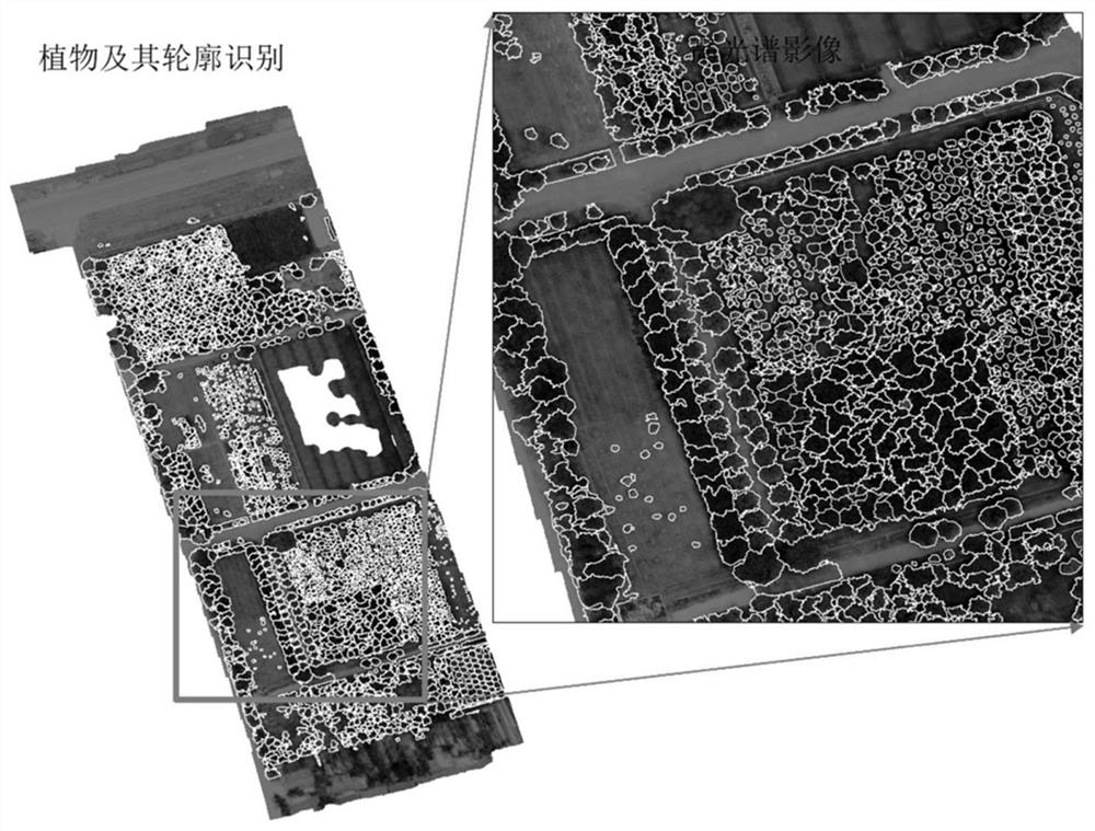
[0224] Such as Figure 1-6 As shown in , the accurate measurement method of urban green space vegetation information digitalization includes the following steps:
[0225] Step 1. Capture images of the target area by manned or unmanned aerial vehicles. The types of image capture include high-resolution panchromatic images, hyperspectral images, and thermal infrared images;
[0226] Step 2. Set a standard reference object on the ground, and record the latitude and longitude coordinates and related information of the reference object, which are used for geometric correction in image preprocessing and accuracy evaluation of vegetation element determination;
[0227] Step 3, extracting the road image in the captured panchromatic image of the target area, and fitting the extracted road information with the landmark point data in the geographic information system, so as to locate the target area and obtain geographic data information;
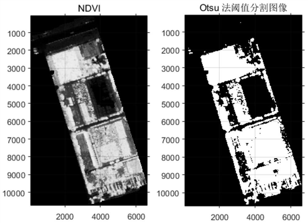
[0228] Step 4. The preprocessing of high-resol...
Embodiment 2
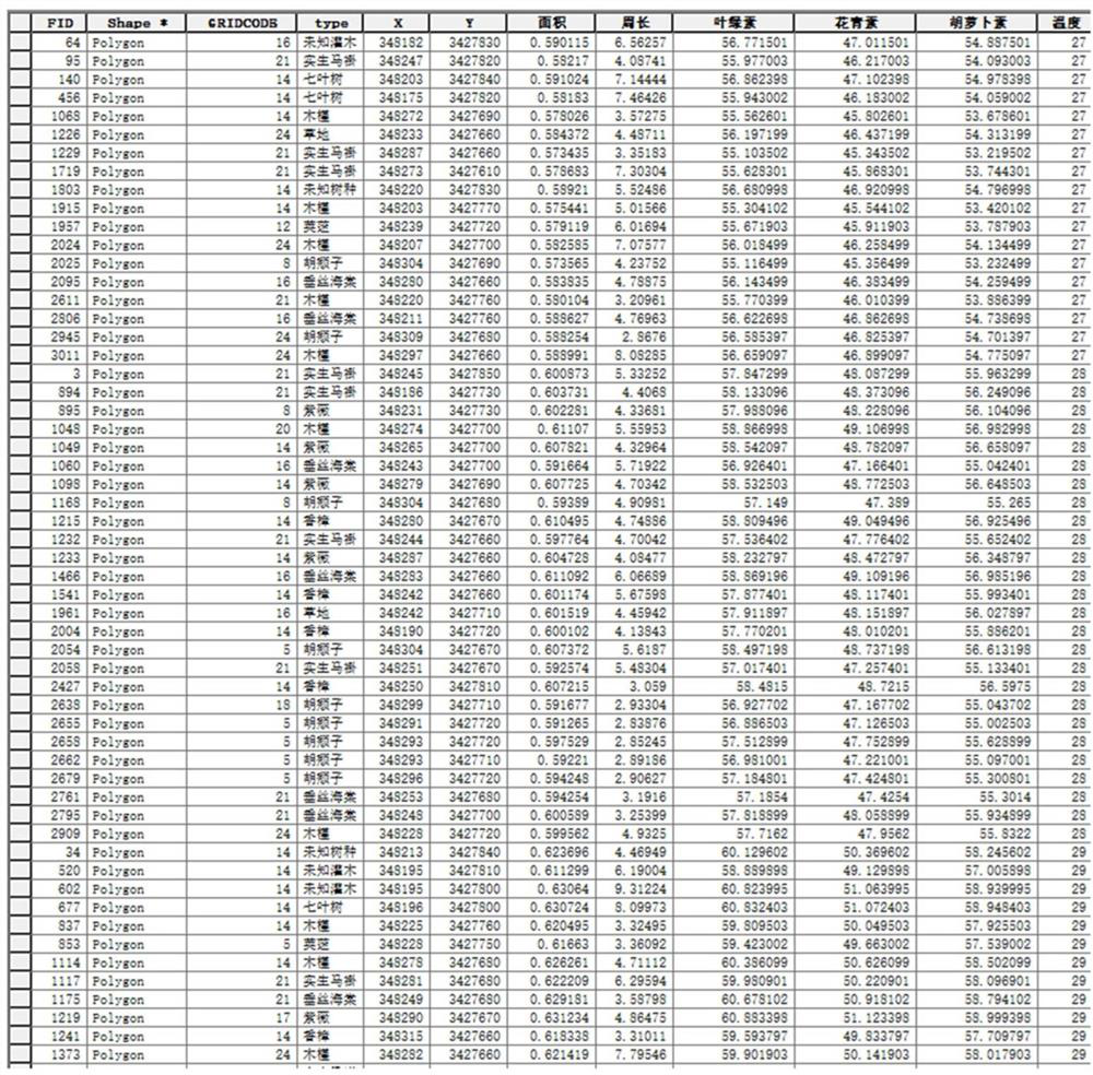
[0239] 1. The test area of this embodiment is located in Wuqiao Nursery Base (121.41°E, 30.96°N), Fengxian District, Shanghai, with an area of 3.83hm 2 . Its vegetation is rich in types. Plants include: Malus halliana Koehne, Loropetalum chinense (R.Br.) Oliver var.rubrum Yieh), Elaeagnuspungens Thunb., Acer palmatum (Acer palmatum Thunb.), Viburnum dilatatum Thunb., Euonymus japonicus Thunb.var.aurea-marginatus Hort., Liriodendron tulipifera'ureomarginatum', Gleditsia triacaanthos'sunburst' ), Hibiscus syriacus Linn., Aesculus chinensis Bunge, Liriodendron chinense (Hemsl.) Sarg., Ribes odoratum Wendland, Cinnamomum camphora (Linn ) Presl), cherry blossom (Prunus serrulata), magnolia (Magnoliadenudata Desr.), juniper (Sabina chinensis (Linn.) Ant.), crape myrtle (Lagerstroemia indicaLinn.), beech (Zelkova serrata (Thunb.) Makino), etc.;
[0240] 2. Collect high-resolution panchromatic images and multispectral data with the help of satellites, manned aircraft or unmanne...
PUM
 Abstract
Description
Claims
Application Information